0

We have been using QGIS to collect and produce maps for fiber optic deployment to areas where there is no fiber. We use OpenStreetMap as the base tile map, for streets and building structures. We also use BING and Google for satellite.

Are there any other options besides or in addition to OSM?

Some of the challenges we have found When we zoom in OSM, the building address number can get blurry, zoom out get to small.

Is there a source (free or paid) that would overlay property lines and address info like in shape file?

On the satellite views, we have seem in other systems, like when we work with Frontier, the satellite imagery is much better and clear especially when you zoom in. I'm sure they pay for it but wanted to ask.

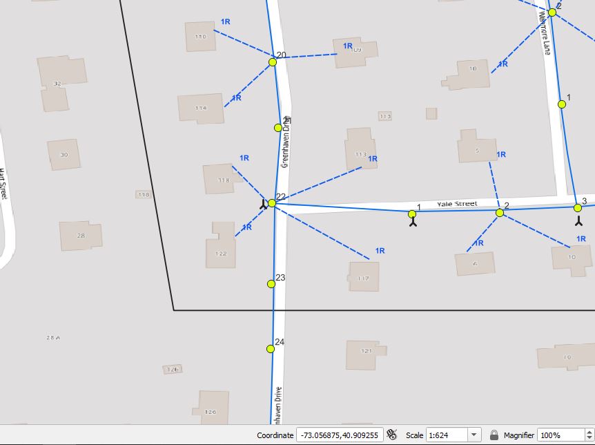
enter image description here

3
  • 1
    Maybe look into the QuickMapService plugin? It has a range of basemaps. Not sure you'll find the exact one you are looking for. Depending on your location, there may be a geoportal with local property data.
    – ChloeG
    Commented Apr 6, 2022 at 15:36
  • I tried that nothing better than OSM
    – Frank
    Commented Apr 6, 2022 at 18:27
  • 1
    If it’s open data that you seek then I think the place to ask is the Open Data Stack Exchange.
    – PolyGeo
    Commented Apr 6, 2022 at 19:34

1 Answer 1

2

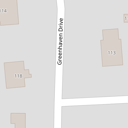
As standard OpenStreetMap tiles only zooms up to zoom 19, which roughly relates to a scale of 1:1000, you get a blurry display by overzooming in 1:624 (your screenshot).

So you should use tiles that a) go higher in zoom and b) best use retina tiles with a higher dpi. E.g. these tiles here: https://www.maptilesapi.com/retina-tiles/ go up to zoom 20 (1:500) plus use a higher dpi (so as a xyz layer you would choose "Tile Resolution High"). Then your basemap would look a lot less blurry.

Example:

enter image description here

3
  • This looks Awesome, I signed up on their website, to sort of take a test drive with Free account, trying to find doc on how to integrate into QGIS? Been playing around for about half hour, tried adding as a new tile - retina-tiles.p.rapidapi.com/local/osm{r}/v1/{z}/{x}/{y}.png?rapidapi-key=YOUR-RAPIDAPI-KEY
    – Frank
    Commented Apr 11, 2022 at 17:38
  • Hi, you'll need the following URL: "retina-tiles.p.rapidapi.com/local/osm@2x/v1{z}/{x}/{y}.png?rapidapi-key=YOUR-RAPIDAPI-KEY" and set the tile resolution to High. QGIS cannot substitute the {r} parameter in the URL; that's why you have to explicitly set it yourself. More information can be found here: rapidapi.com/MapTilesApi/api/retina-tiles/tutorials/…
    – crnm
    Commented Apr 12, 2022 at 14:31
  • Thanks again, this was perfect, really appreciate the assist.
    – Frank
    Commented Apr 13, 2022 at 11:01

Your Answer

By clicking “Post Your Answer”, you agree to our terms of service and acknowledge you have read our privacy policy.

Not the answer you're looking for? Browse other questions tagged or ask your own question.