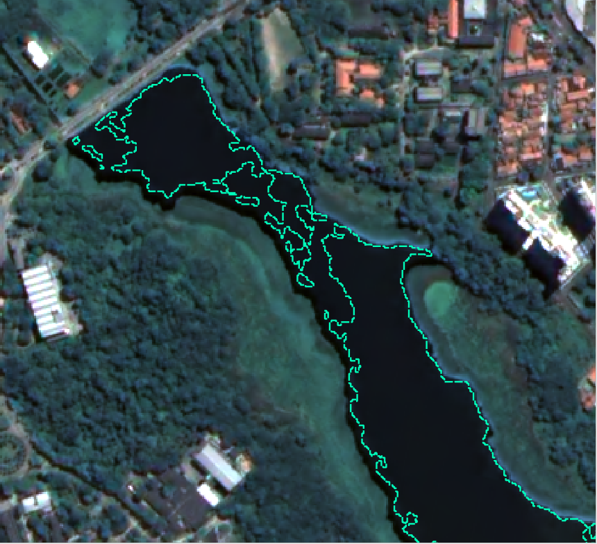
I used a water index (NDWI) to extract pixels from a raster, then turned it into a polygon layer. The goal is to create samples for image classification. Now, the resulting layer is kind of patchy, and I'm trying to figure out if there is a way to fill up the space between those polygons that are within a certain distance (let's say 50 meters), and merge them. If that space could be filled, I guess it would be simple to merge, really. I'm using QGIS.
-
4You could try buffer by 50m with dissolve then buffer by -50m to move the unaffected lines back to somewhere close to their original location.– Michael StimsonCommented Sep 28, 2022 at 2:44
-
1You could play around with the raster to fill the gaps before you convert it to polygons. For example with Raster Calculator to set the values above som threshold to 1 and the other values to 0. Adjust the threshold until the gaps are filled, then convert to polygons– BeraCommented Sep 28, 2022 at 5:15
Add a comment
|

