2

Since there aren't any georeferenced points on the site, we're creating a local grid using a few close locations as references as I use a total station to do some measuring.

Aerial photographs can be used to establish the approximate coordinates of these locations, at least accurately enough for our purposes.

How can we use QGIS to convert our local coordinates into UTM or any other type of global coordinates in the easiest way possible?

CAD is presently being used to shift and modify the coordinate values, but that is not the most elegant or efficient approach.

0

1 Answer 1

3

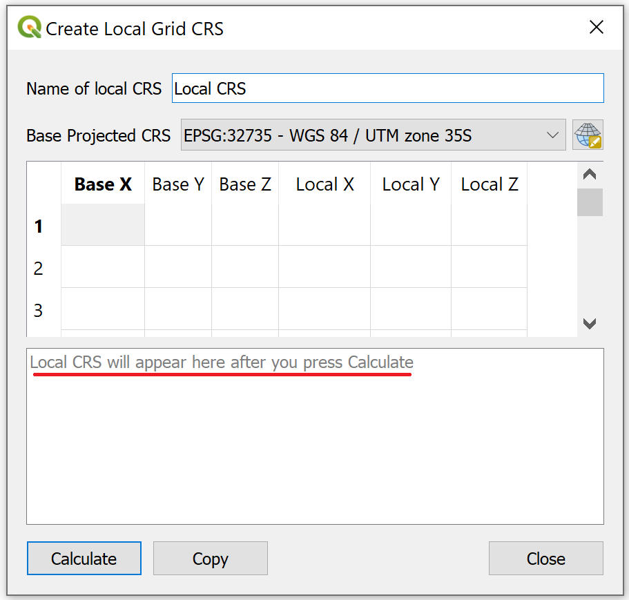
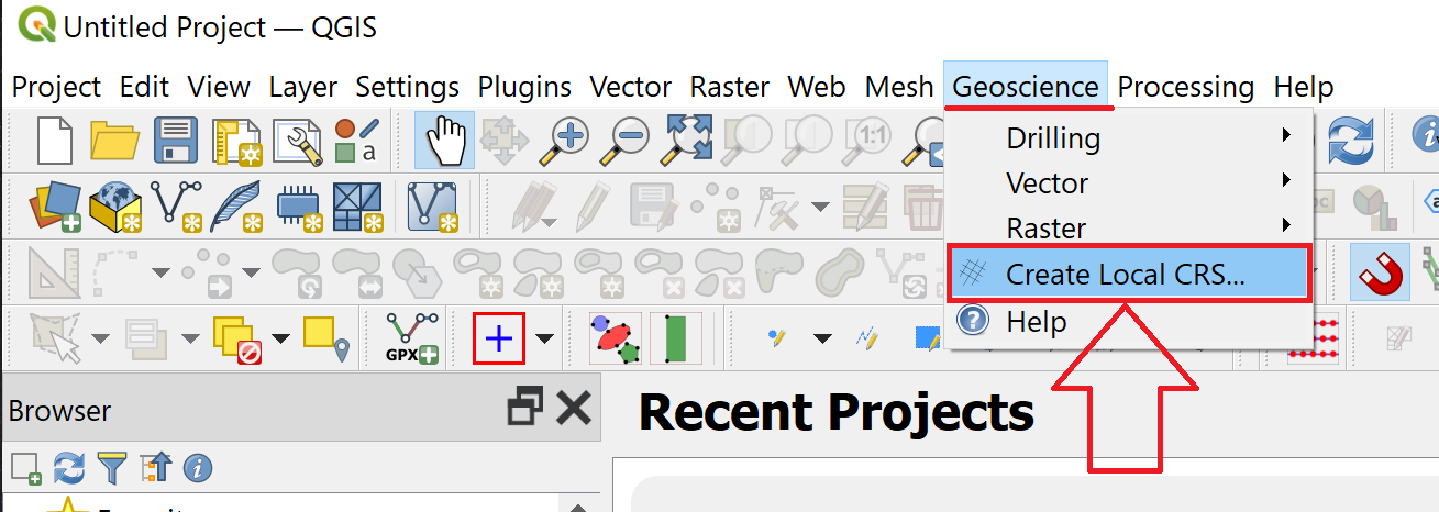
I do this all day long with Excel and AutoCAD Civil 3D, but since you think AutoCAD is not "elegant or efficient", I'll show you how to do this with QGIS. Use the GeoScience Plugin and select "Create Local CRS..." which takes you to a page where you put in at least 3 tie points. When you hit "Calculate" it gives you a WKT for a Custom Projection. From there you can transform "on the fly" to anything you want.

enter image description here

enter image description here

0

Your Answer

By clicking “Post Your Answer”, you agree to our terms of service and acknowledge you have read our privacy policy.

Not the answer you're looking for? Browse other questions tagged or ask your own question.