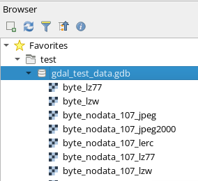
I try to open an Esri raster.gdb in QGIS (Open 25m Raster DEM, Altalis, Calgary, canada). I use 3.36.1-Maidenhead QGIS (Version de GDAL/OGR 3.8.4)
Some "layers" are created but I can't do anything with them. It seems to be attribute tables with only one record.
And I have the feeling that all the rasters are not imported. In the original .gdb directory, there are 117 files, the biggest one (raster ?) weighs 4GB.
To import the .gdb directory, I use the classical method (Add vector layer, directory, gdb database) you can find everywhere on YouYube.
Do I do something wrong?


