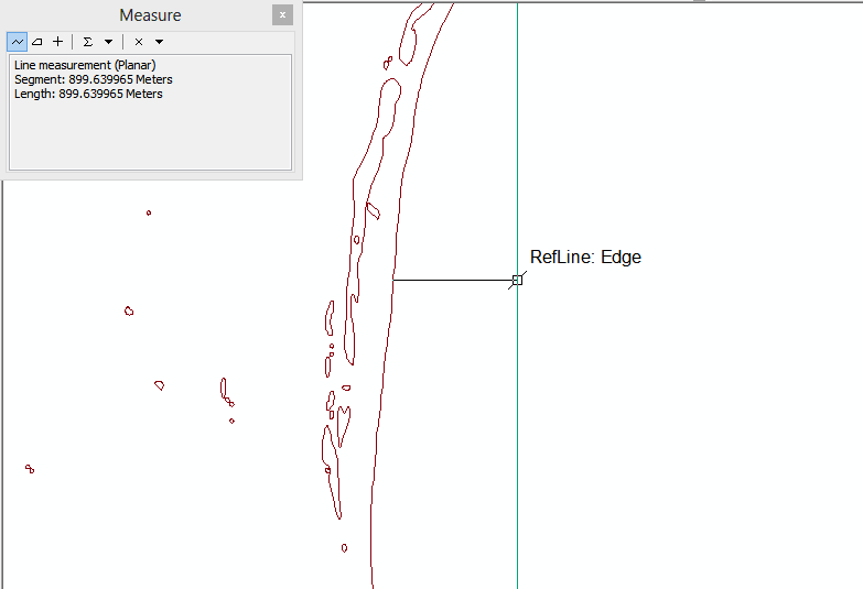
I have multiple shapefiles, each containing a coastline for a specific year. I want to calculate the perpendicular distance to the shoreline from a fixed vertical reference line.
Please recommend me the best tool (in ArcGIS-Desktop) to find out the perpendicular distance from each point (or a definite number of multiple points) on the reference line to the shoreline shapefile. I have included a screenshot to describe what I am planning to achieve.
I am hoping to be able to create 1 custom point per 100m on the reference line and then calculate the distance to the shoreline from these points.

