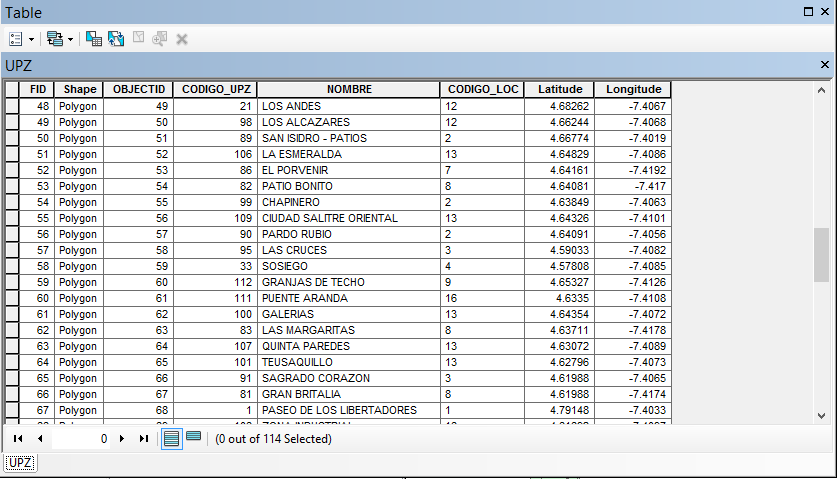
intermediate ArcMap user here. I'm trying to calculate the geometry for a shapefile such that I can add lat/long columns to my attribute table. While I have no trouble calculating the latitude, the longitude keeps coming out a decimal place off.

I know that the accurate longitude for this shapefile should be -74.067, -74.068, etc. I'm not sure if the negative sign is screwing up the significant digits? I looked around StackExchnage and no one seems to have this problem.

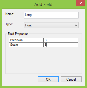
For reference, when calculating the Latitude, for "Type", I used "float" with precision = 6 and scale = 5. This worked fine for Latitude but still gives me the incorrect result for Longitude.
Also for reference: Projected Coordinate System: PCS_CarMAGBOG Projection: Transverse_Mercator False_Easting: 92334.87900000 False_Northing: 109320.96500000 Central_Meridian: -74.14659167 Scale_Factor: 1.00000000 Latitude_Of_Origin: 4.68048611 Linear Unit: Meter
Has anyone faced this problem before, and if so, how did you resolve it? Is the problem in calculate geometry or in the projection itself?
