I have seen this post:Watershed Analysis with GRASS, and I have a .txt file which contains coordinates of many points, and I want to use r.water.outlet to get basin area of each point.
I type the following code in the post:
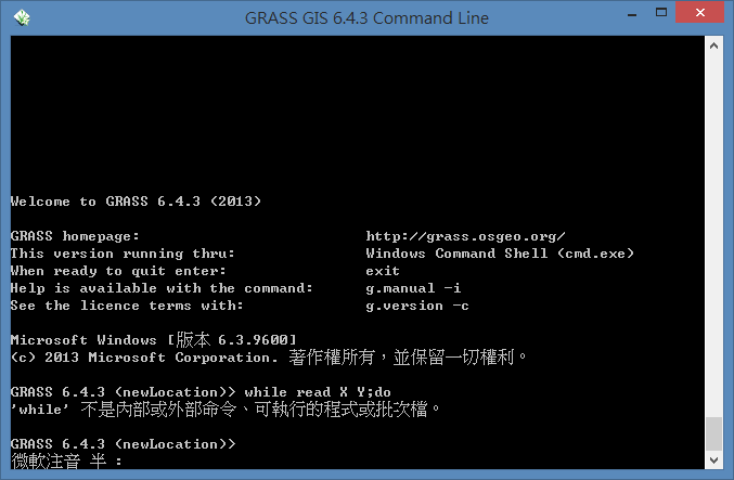
while read X Y; do
.... ;
done < cross_pts.txt
and in GRASS command line, it shows:

I already import the DEM file and successfully run r.watershed to get the drainage file in GRASS, but I do not know how to follow the guide in the post.
I am new to using command line and know nothing about bash script. How can I loop through all different coordinates? I am using GRASS 6.4.3 under windows8.
