1

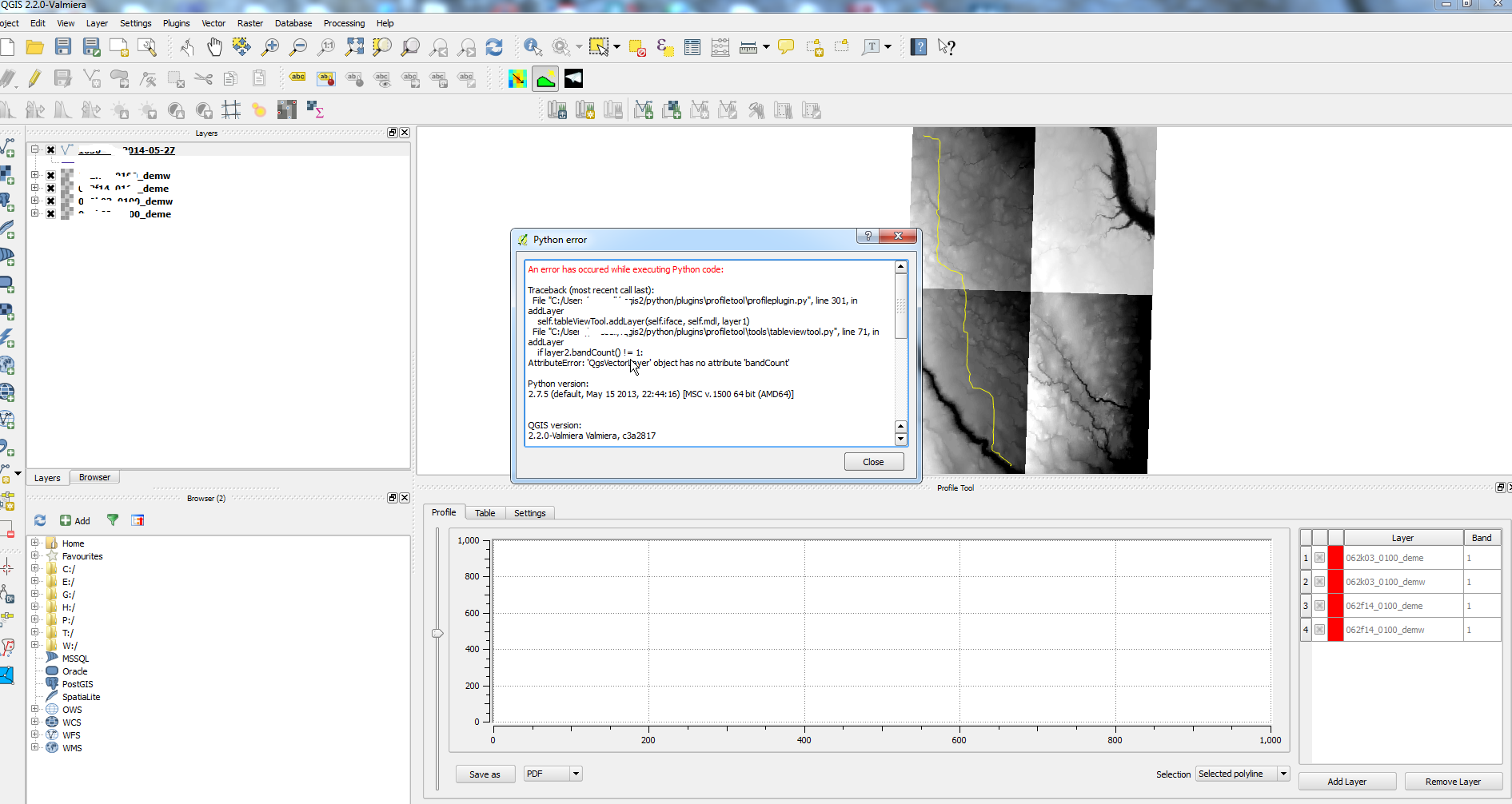
I have searched the home page for the "terrain profile" tool but have not found why I am getting error when trying to utilize it.

Any ideas?

I have a polyline and 4 dems ready to run the tool.enter image description here Would like to export the profile as an image and excel file.
6
  • When does the error appear? What are you trying to do at that point?
    – underdark
    Commented Jun 4, 2014 at 18:05
  • I am clicking on "Add Layer" with the polyline highlighted.
    – sirgeo
    Commented Jun 4, 2014 at 18:31
  • If I remember correctly, you just have to click on the line in the map while the vector layer is active. The "Add layer" button is only for the raster layers.
    – underdark
    Commented Jun 4, 2014 at 19:06
  • After selecting the polyline nothing happens... an I missing something with "while the vector layer is active"?
    – sirgeo
    Commented Jun 4, 2014 at 19:12
  • Click on the line while the profile tool is active. I don't mean the usual select tools.
    – underdark
    Commented Jun 4, 2014 at 19:15

1 Answer 1

3

The "Add layer" button is only for the raster layers.

To get the profile for a certain line:

  1. activate the line layer (= highlight it in the layer list)
  2. activate the profile tool (in the toolbar)
  3. click on the line feature on the map
1
  • ..and also make sure you have chosen 'Selected polyline' and not 'temporary polyline' within the profile tab of the Profile tool (the cursor will change to a hand from a cross)
    – user19425
    Commented Jul 14, 2014 at 9:37

Your Answer

By clicking “Post Your Answer”, you agree to our terms of service and acknowledge you have read our privacy policy.

Not the answer you're looking for? Browse other questions tagged or ask your own question.