ArcGIS 10.2.2 on Windows 7 32 bit (new Win 7 computer arriving tomorrow).
I'm a complete novice to ArcGIS starting now (June 2014), so speak loud and slow...
I have 10 years of experience with GIS - just not ESRI, so I know what I want to see, now how do I see it?? I've checked the Help, but following the guidance doesn't seem to work.
I'm drawing a small cemetery (4,000 spaces on a few acres). I want lot labels to appear on the grave lots when I'm at a zoom scale of 1:1 to roughly 1:500 but not any higher. As the user zooms in and out, these labels should remain one size relative to the polygon in which they pertain. So when zoomed out they should be rendered in an illegibly small font. Above that zoom scale (1:501 and further zoomed out) I would like a block number to appear (blocks are on a different layer). I would like the block number to appear only out to about 1:10,000 and then disappear at 1:10,001 and further out. At 1:10,001 and further I would like to see section labels appear.
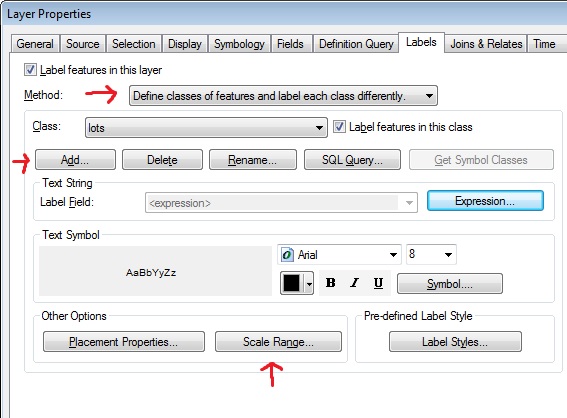
I've been using the standard Label Manager. Click on Scale Range... and make the appropriate changes to Out beyond and In beyond, but that seems to do nothing. What am I missing to make this work?
There seems to be a link between these zoom scales and the Frame Reference Scale. I have tried a Frame Reference Scale of , 1:300, and 1:24,000. There is no change from one to the other that I can see when I change these.
Also will all these scale zoom visibility features make the jump to a Geodatabase file when I'm finished? This is the most critical part. It will be going to an ArcGIS Online account, and this zoom rendering is what I'm shooting for.

