6

For a project, I need to create a set of vector data that I think I could do in QGIS. However, the customer requires that the final data set needs to be delivered in a Esri File Geodatabase.

Is there a way to export geodata from QGIS into an Esri File Geodatabase?

2 Answers 2

6

This answer was written for version 2x of QGIS.

You can create one off file geodatabases(s) by right clicking on the layer in the Layers TOC>Save As, and change the format type to ESRI FileGDB:
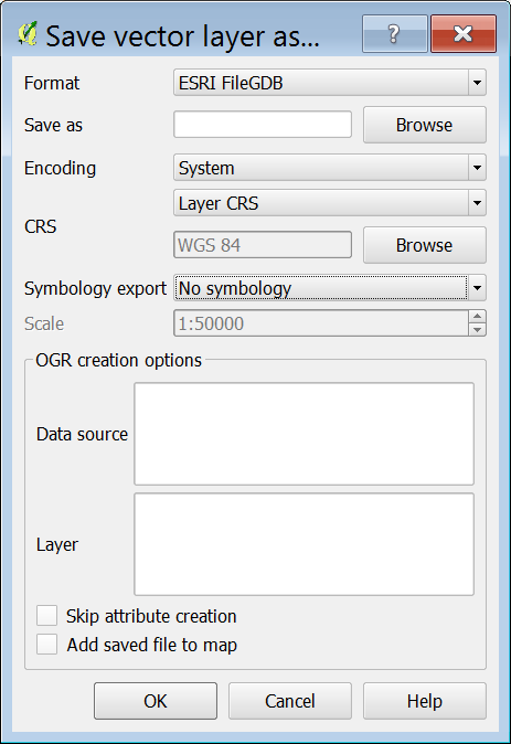
enter image description here

There does not appear to be a way to export various features classes though to one geodatabase from the GUI.

Alternativly, you could create your separate tables in a SQLite DB within QGIS, and use OSGeo4W Shell (should be installed with your QGIS) using ogr2ogr command line to convert from SQLite to ESRI FileGDB, see example expression below:

ogr2ogr -f "FileGDB" C:/Temp/Temp.gdb C:/Temp/Temp.sqlite
0
-1

save selected faeture as option showns (appear) when shapes are selected on the screen

0

Your Answer

By clicking “Post Your Answer”, you agree to our terms of service and acknowledge you have read our privacy policy.

Not the answer you're looking for? Browse other questions tagged or ask your own question.