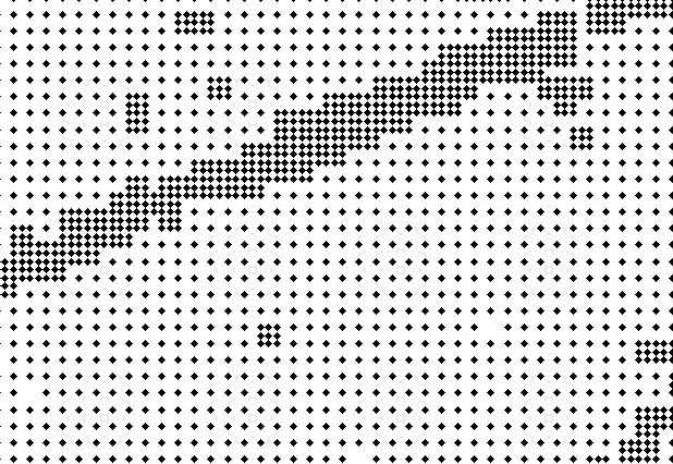
The concern that I have is that lidar is not a systematic sample, as shown in your example. This data appears to have already been gridded and then thinned based on terrain or vegetation variation. Given the short-distance variation and observed spatial pattern of the clustering, my guess is higher point spacing was retained due to vegetation (e.g., trees). One question would be if this point data is bare-earth or does it have vegetation retained?
If this data has, in fact, been pre-gridded then applying an interpolation with a higher resolution than the observed point spacing may propagate bias from whatever previous algorithm was applied. This could give you something akin the the derivative bias observed in 10m USGS DEM's.
That said and bias aside, the higher resolution spacing is likely supported regardless of application. If you are after vegetation and it is present in the points then you would want the resolution it is represented as. If higher density represents higher terrain variation then the 4m spacing is more homogenous and, if the processing procedure was valid, the higher resolution is supported.
This is, of course, all predicated on the assumption that the data was thinned, based on some sort of homogeneity/heterogeneity criteria, is correct. Other than for specific analytical purposes, I do have to admit that I am completely baffled as to why one would do this.

