I have two types of Road shape files. Road (Polyline) and important points (waypoints) along the road. Both of these shape files are prepared using GPS. I want to find the chainage of the points. Is it possible using QGIS ?
1 Answer
You can accomplish it by using the QGIS plugin LRS that enables linear referencing support for QGIS. This would be the work flow:
Based on both a line (routes) and a point (for calibration) layer, go to the Calibration tab.
- Select the line layer with its route field (a field that identifies routes, it's very useful if your line layer has several routes).
- Select the calibration point layer with its corresponding route (point route value should match with the line route value) and measure field. As you can see, you would need a calibration point layer with at least two points, that could be located at the start and the end of the route, with values of 0 and 15000 in case that the route has 15km.
- Click on Ok to interpolate M values along the routes.
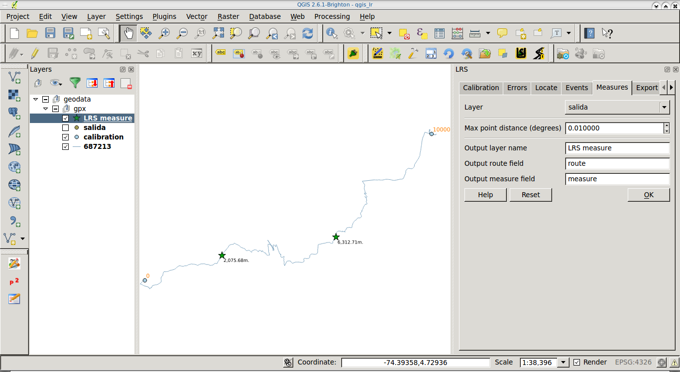
Go to the Measures tab.
- Select your waypoints layer.
- Fill the output field names.
- Click on Ok to get a new (memory) layer which will contain the M value (chainage) of waypoint.
Don't forget to save the layer you obtain from 2., since it's a memory (temporal) layer. If you want the M values in your waypoints layer, perform a table join between waypoints and the layer you obtained from 2.
In the following screenshot you can see a sample route, a couple of calibration points in blue, and a couple of points along the route (green stars) with their calculated chainage (M value).

-
Not sure why, but I had better luck using a string for the route field than an int Commented May 21, 2018 at 21:16
