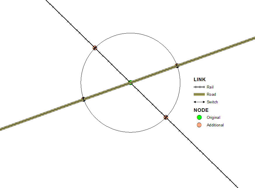
I am constructing a multi-modal transportation network using Network Analysis on ArcGIS. I have data on roads, railway, and rivers for the U.S. My goal is to calculate an Origin-Destination matrix of the cost to transport goods from each U.S. county to each port along the U.S.'s coastline.
What I would like to model is the fixed cost of switching modes of transportation. For example, goods transported using roads would incur a fixed cost of $500 to switch to railway transportation. This fixed cost may include the cost for unloading the truck, storage in a warehouse until departure, and loading them on a train.
What would be the simplest way to include this fixed switching cost in a work database?
I am using ArcGIS 10.2.2 for Desktop and the Network Analyst Extension.

