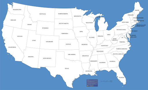
I am very new to QGIS and mapping. I am trying to load a US state map shapefile in QGIS. But the problem is it does not look like another US state map available on the internet. The upper part looks very straight. Am I missing something? Do I need to convert to any other format before displaying?
-
1they are different projections try census.gov/geo/maps-data/data/cbf/cbf_state.html– Mapperz ♦Commented Mar 15, 2015 at 18:45
-
Thanks. This is the file that I am using. I am using the default settings in qgis. is there any settings that I need to change?– Muhammad RazibCommented Mar 15, 2015 at 18:58
-
1You should be aware that the northern boundary of the western half of the lower 48 states follows a line of latitude exactly, so it is not unusual for it to be perfectly straight on any cylindrical or pseudocylindrical projection.– Random832Commented Mar 16, 2015 at 14:20
3 Answers
As Mapperz said, the data you have and the map example are using different projections. You may want to research the topic, as it is fundamental to GIS. If you want to change the appearance, you need to Reproject the data (aka change the coordinate system or CRS). I believe the data you have comes in GCSNAD83. Your map example looks like it might be using an Albers Equal Area Conic projection (but I'm not terribly good at picking them out just by sight). Note that a projection well suited to the contiguous 48 states may significantly distort Alaska and Hawaii, and one that is suited to showing all 50 states may not show the contiguous/lower 48 in quite the same way. See the QGIS documentation for specific instructions in working with projections.
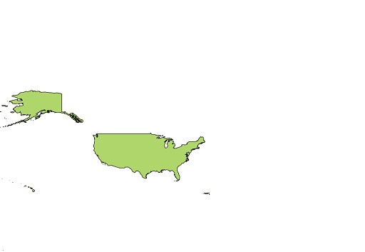
Your shapefile is probably the whole USA without state boundaries. Google USA states shapefile or go https://www.census.gov/geo/maps-data/data/tiger-cart-boundary.html and download the USA states shapefiles in the data section.
To get exactly the color of the other map you need to right click the shapefile in qgis and head to properties- symbology and play with it.
-
Thanks for the reply. I got the shapefile from the same location as you suggested. Don't know what is the problem Commented Mar 15, 2015 at 19:43
4/23/2018 - For anyone who arrived here through Google, there is a full explanation about map projections in QGIS Documentation here: Reprojection Chapter 7 of QGIS Documentation