1

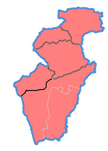
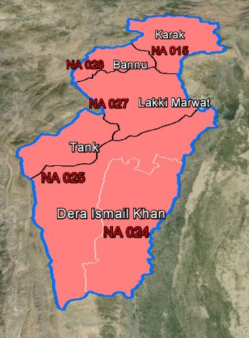
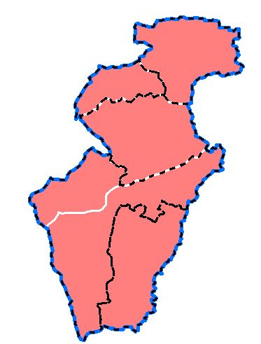
I have been working with kml files. I'm using ArcGIS 10.0 and use the option "Map to Layer" from "conversion Tools" in "Arc Toolbox". Problem: I have two layers, say Districts and Constituencies, which overlap at places. I have given different boundaries of different widths, but after export it shows only one boundary (at places where they overlap). I tried applying dashed boundary to one of the layers (upper) but it still did not work.

It works good in Arc but any suggestions how can I make both boundaries look prominent in kml. For Example:
enter image description here

OR

enter image description here

Output:

enter image description here

2
  • I think it would be better if you could give an example of what the resulting KML does look like, assuming that the images you posted above are from ArcMap prior to the export. Also, what layers are in your TOC? It looks like at least 3: one of the whole area with a blue border, one of the white border areas (bottom image), and one of the black border areas with red fill, but it's hard to say for sure.
    – mr.adam
    Commented Mar 26, 2015 at 18:54
  • @mr.adam Thank you very much for your response. I have added the output for your convenience. Additionally, I'm using two more layers for labeling. I have no idea why, but labels on polygons do not show up in kml.
    – Ade'l
    Commented Mar 27, 2015 at 6:06

1 Answer 1

3

Try layering the TOC something like this (disregarding the label layers) and then use Map to KML:

  1. Districts: empty fill, white lines 1pt

  2. Constituencies: empty file, black lines 2pt

  3. Full Area (run dissolve tool on one of the above layers): red fill, blue outline 3pt

It's especially useful to have separate layers because you can toggle them in GE. If you still need separate layers for the labels, do this in ArcMap so the labels turn on and off with the appropriate layers:

  1. Districts (group layer)

    labels (District label layer)

    boundaries (District layer as described above)

  2. Constituencies(group layer)

    labels (Constituency label layer)

    boundaries (Constituencies layer as described above)

  3. Full Area (as described above)

3
  • thank you for the help. Its working with a little discrepancy. Somehow the order changes when it is exported to GE. Previously I had been using full area and districts in one layer and the idea of dealing them separately helped a lot. Any idea as to why the order changes after export and thin layer hides under the thicker one. As in the graphics I shared I'm using similar technique but no idea why the order changes.
    – Ade'l
    Commented Mar 30, 2015 at 7:24
  • Honestly, I'm not sure how GE draws things, because I've found the same issue: polygons that are "underneath" others in the "Places" panel are sometimes drawn on top of others that should be "on top". My solution has just been to make sure each layer can easily be turned on or off by the end user.
    – mr.adam
    Commented Mar 30, 2015 at 14:24
  • 1
    Thank you for your help and apologies for being so late... What I did to work it out is: since I had same format of clusters, I tracked which layer appears first and which layers follow and then map accordingly in ArcGIS before conversion. This worked for me.
    – Ade'l
    Commented Apr 7, 2015 at 5:13

Your Answer

By clicking “Post Your Answer”, you agree to our terms of service and acknowledge you have read our privacy policy.

Not the answer you're looking for? Browse other questions tagged or ask your own question.