I am using ArcGIS 10.1 for Desktop.
I have a value raster and a polygon feature in GCS coordinates. My raster resolution is 0.5 decimal degrees which is much larger than the size of my polygons. My value raster has discrete floating points. So I resampled my raster to smaller resolution of 0.01 using the NEAREST option and used Zonal Statistics in table to get the mean value for each polygon. However when I compare the means of the bigger polygons that have zonal statistics values for both original and resampled raster, I find that the resampled values are higher. My raster values are in terms of mm/sq km. So the small difference during resampling is amplified when I scale the value up with the polygon areas. Any ideas how to prevent this?
I have also tried doing the same with projecting both my raster and polygons to WGS and then resampling and zonal statistics. But i get the same trends in the results. Am I missing something?
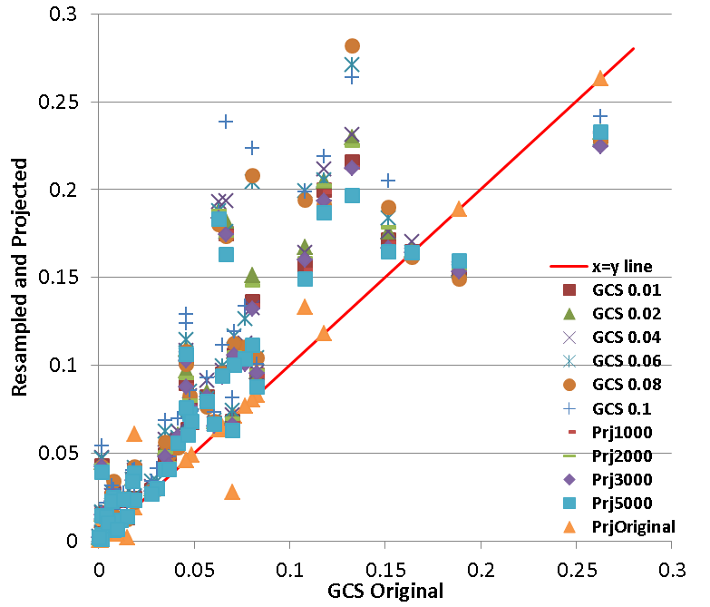
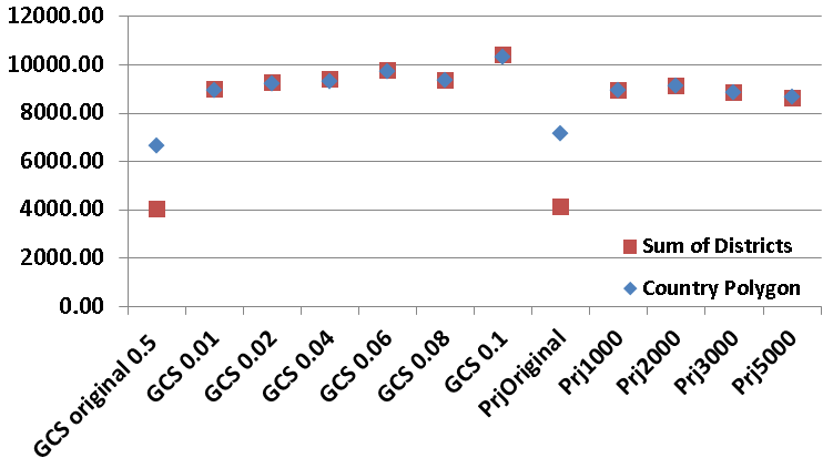
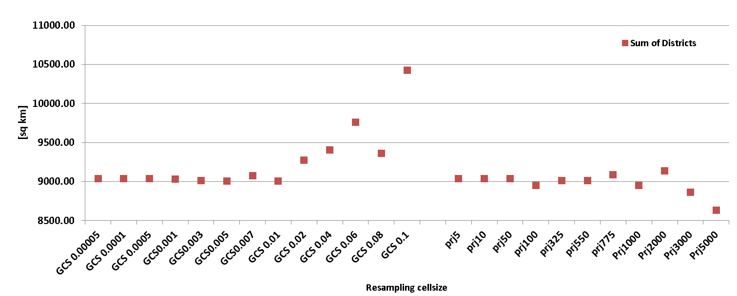
Following are 2 graphs showing: 1) comparison of regional zonal means evaluated using original GCS raster and evaluated using resampled/projected+resampled rasters 2) comparison of country level values (zonal mean*area) and sum of all district values
It seems that the country level and sum of district level values match each other. But both are generally higher for resampled and projected rasters. So resampling is giving me higher zonal means.


