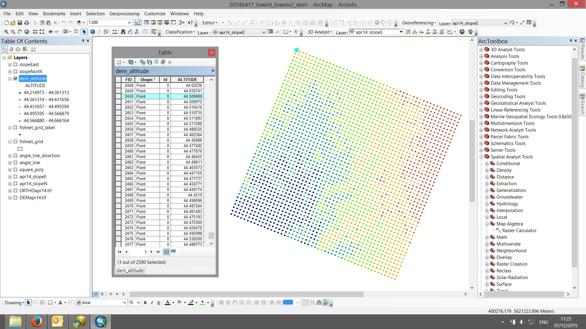
I have a grid made of points (see attachment) with values for altitude extracted from a DEM. I need to export these values not as list, but as a matrix of size 50x50 to be read in SciLab. The grid is already made of 50x50 points, so the size is not really the problem. The problem is that all the methods I find to export the data have a list of values as the output, instead of the matrix shape I'm looking for. The matrix origin should be the topmost point in the attached picture (highlighted).This matrix will be used in a model to calculate water current velocity in a spatially explicit environment.
1 Answer
Your data is a point shapefile and you want the elevation output in a matrix format?
Well the way to do this is to convert your point data into raster then run the raster to ASCII tool. This will create an ASCII text file where each cell has the elevation. As your point data seems to be rotated the output will create no data where there are no points within the extent of the dataset.
-
It worked like a charm. To avoid having zeroes I rotated the grid back. So thanks mate. Commented Dec 10, 2015 at 14:08


Sortshould do the trick.