This may seem quite a simple question for which I couldn't find a satisfactory answer. I have been trying to understand how resampling of raster work with ArcGIS 10.3, in both cases of refining and coarsening, especially at corner and edge cells.
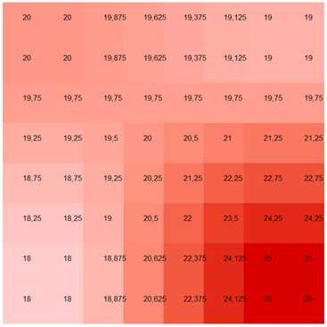
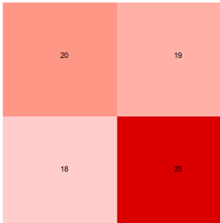
For descriptive purposes, I have chosen an input raster with 4 cells of size 1x1m which I resample to a cell size of 0.25x0.25m using different resampling techniques.
With bilinear resampling technique, I got this result:

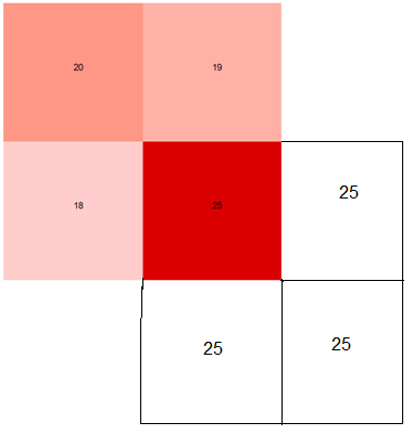
What I couldn't understand here is why the four cells at all four corners have the original values. If it is taking distance weighted average of four input cells, the values would be different. Or ArcGIS is adding three extra cells (of same value as the corner cell) at the corners beyond the edges of the input raster such that four closest cells of the four corner cells on out raster always have the same value of original corner cell? Something like this:

One more thing to mention is when I used cubic method, I got the same result as with bilinear method. In this case, the input raster has only four cells; how does cubic method calculates a distance averaged value from 16 cells?

