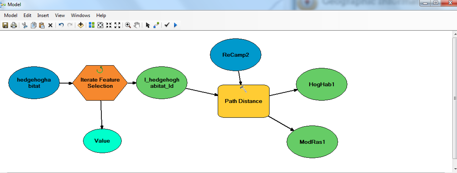
I am trying to create a model in ArcMap that will run a path distance analysis on each individual polygon in a feature class.
Below is the model I have so far but it is only outputting one path distance rather than an individual one for each of the polygons in my feature class.
I have selected 'Id' as the field in the Iterator (each polygon has a different ID number'. The output from the iterator is my input feature in my path distance tool and then the 'ReCamp2' is my input cost raster.
Do I need another tool to get my path distance to save the results from each polygon separately?

