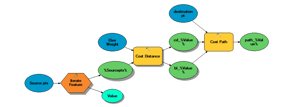
I have multiple source points in one shapefile and one destination point in a separate file. I would like to find the least cost path from each source point to the destination point. My costs are weighted using a DEM (elevation only). I am using ModelBuilder to iterate over each source point to produce a cost distance and cost backlink raster to feed into the cost path tool.
I've run the iterator and cost distance tool and they function properly, but when I add in the cost path tool, I get multiple errors after the first source point run:
ERROR 010236: Error in building VAT.
ERROR 010067: Error in executing grid expression.
ERROR 010414: Error in creating a Raster from a geodataset.
Failed to execute (Cost Path).
I'm not very Python-savvy and am using ModelBuilder.

