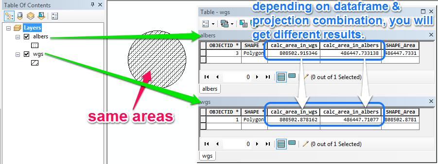
So I've been tasked with automating a formerly manual process in model builder in which I'm trying to calculate land area.
In the former manual process the feature class was brought into ArcMap and the dataframe's projection was switched from a Lambert conformal conic projection to a Albers equal area conic projection. The area was then calculated through the Calculate Geometry dialog in the attribute table.
To replicate this in a model I use the Project tool which creates a new feature class in the Albers projection and then the Calculate Field tool using !shape.area@SQUAREKILOMETERS! as the expression.
Generally speaking this all works fine. The issue that comes up is that in comparing previous results from the manual process to the automated process there are slight differences in the calculated area. Most of the time this is on the order of a fraction of a square meter in some features with the difference for the whole feature class hovering around 1 square meter total.
Is there a reason for this difference? Is one method more correct than the other? My thought is that it has something to do with tolerances and vertices snapping to different locations during projection of the feature class but I'm not sure.
Ultimately the difference is miniscule but there is a difference and I'm wondering why?

