I'm using PostGIS2.0 to do some raster/polygon intersections. I'm having difficulty understanding which operation I should use, and what the quickest way of performing this is. My problem is as follows:
- I have a polygon and a raster
- I want to find all the pixels that fall within the polygon, and get the sum of the pixel value
- And (updated problem): I'm getting massive values for some pixels that do not exist in the original raster when I perform the query
I'm having difficulty understanding whether I should use ST_Intersects() or ST_Intersection(). I also don't know what the best approach for summing my pixels is. Here is the first approach that I have tried (#1):
SELECT
    r.rast
FROM
    raster as r,
    polygon as p
WHERE
    ST_Intersects(r.rast, p.geom)
This returns a list of rast values, which I'm not sure what to do with. I tried calculating the summary statistics using ST_SummaryStats() but I'm not certain if this is the weighted-sum of all the pixels that lie within the polygon.
SELECT
        (result).count,
        (result).sum
FROM (
         SELECT
            ST_SummaryStats(r.rast) As result
         FROM
            raster As r,
            polygon As p
         WHERE
            ST_Intersects(r.rast, p.geom)
    ) As tmp
The other approach which I have tried (#2) uses ST_Intersection():
 SELECT
        (gv).geom,
        (gv).val
 FROM
 (
    SELECT
        ST_Intersection(r.rast, p.geom) AS gv
    FROM
        raster as r,
        polygon as p
    WHERE
        ST_Intersects(r.rast, p.geom)

      ) as foo;
This returns a list of geometries that I analyze further, but I assume this is less efficient.
I'm unclear on which is the quickest order of operation also. Should I always choose raster, polygon or polygon, raster, or convert the polygon into a raster so that it is raster, raster ?
EDIT: I updated approach #2 with some details from R.K.'s link.
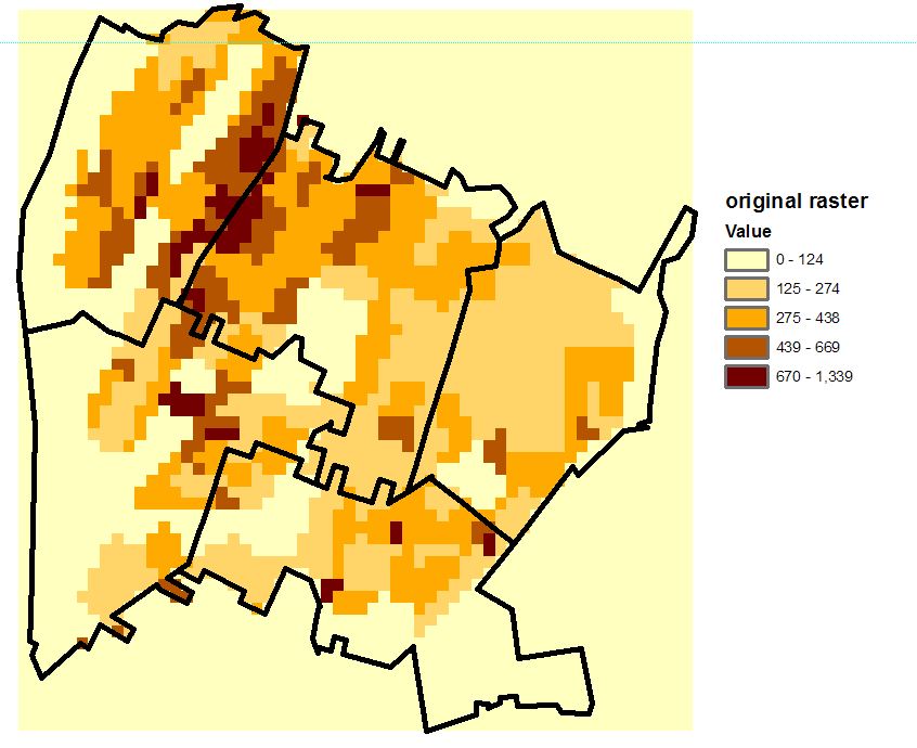
Using approach #2, I have noticed the following error in the results which is part of the reason why I did not understand the output. Here is the image of my original raster, and an outline of the polygon that is being used to intersect it, overlaid on top:

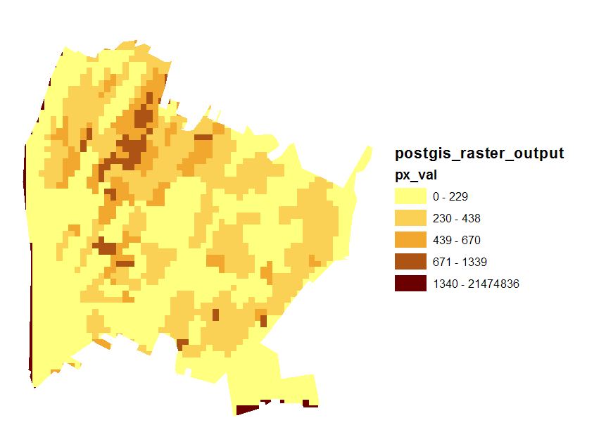
And here is the result of the intersection using PostGIS:

The problem with the result is that there are values of 21474836 being returned, which are not in the original raster. I've no idea why this is occurring. I suspect it is related to small numbers somewhere (dividing by almost 0), but it returns the wrong result.

ST_SummaryStats()for #1, but am not sure how to do it for #2.