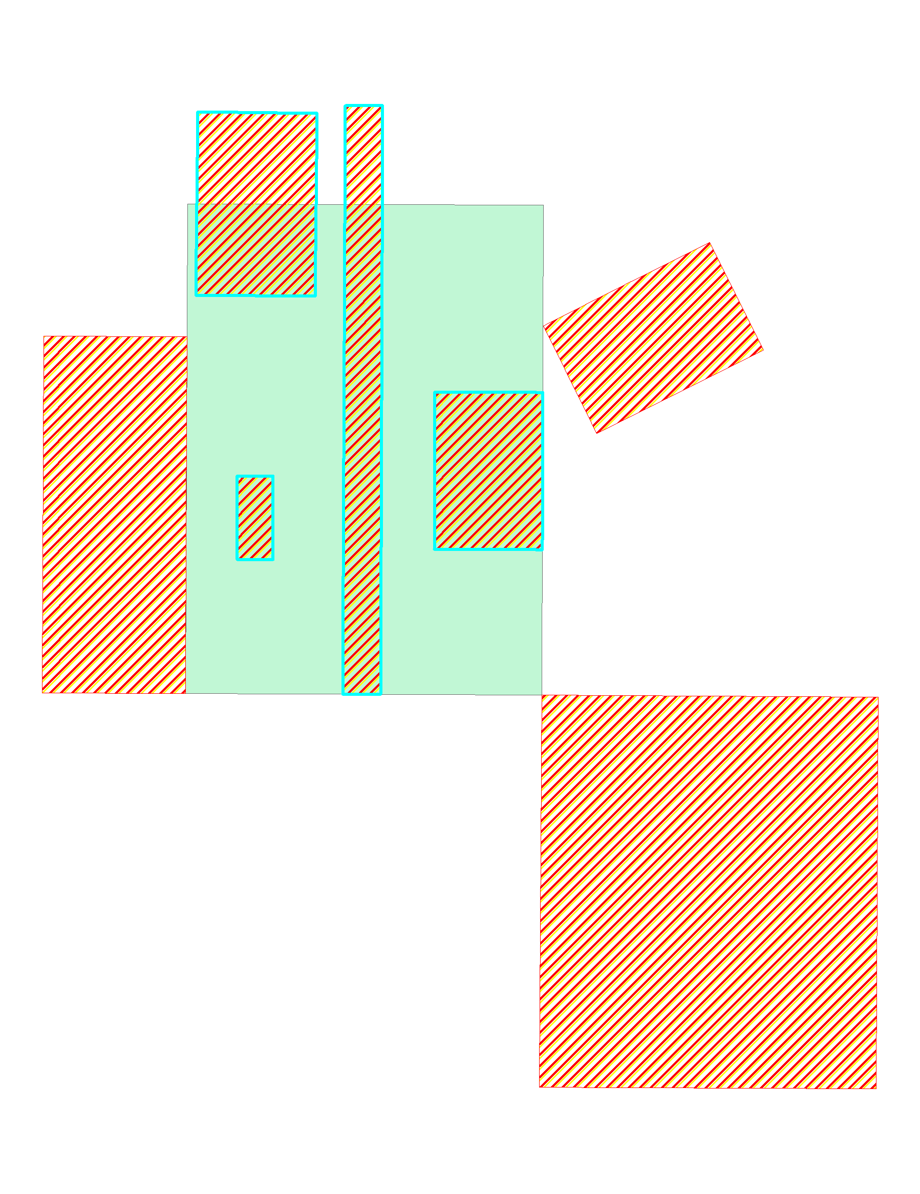
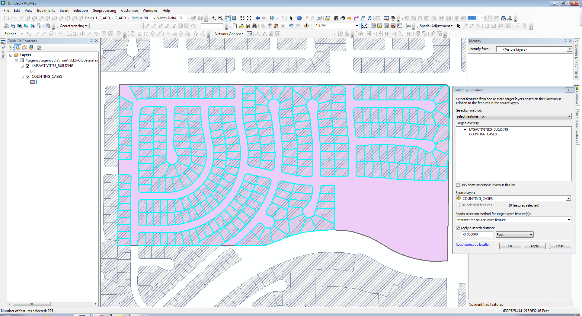
My non-GIS coworkers are always baffled by the results of intersection queries, because they expect the result pictured below, but instead, they get every single feature being selected.
Part of the problem is that ESRI uses the term "intersect" to refer to both of these, completely different spatial relationships (see: Select by Location Intersect vs the Intersect analysis tool).
I always use work-arounds (typically a union/intersection analysis and then a series of cursors), but there must be a spatial relationship defined somewhere in ESRI's capabilities that selects features as selected in the picture below based on their relationship to the underlying, green feature. That mystery definition is apparently used in the Intersect tool, but what if we want to stop it short of cutting the features and instead copy the entire feature that otherwise would be sliced up and only partially retained?
Is there some other tool where such a selection capability might exist?
It's an "overlap", as simply and straightforwardly interpreted everyday in our language, so where is it in ArcGIS?


