I've been working on a bunch of layers of differing co-ordinates projections within a single dataframe. Because I haven't really got my head around this, and because its all been working just fine, I didn't want to touch it.
However, one of the functions I was trying to perform wouldn't work (extract multi values to points) and I suspected this was because of coordinate conflicts.
My data frame properties show that I have layers with the following coordinates in it:
GCS_WGS_1984
NZGD_2000_New_Zealand_Transverse_Mercator
NZGD_2000_Transvers_Mercator
NZTM
I guess they should all be on the same.
I have just tried to change the projection of 3 layers (why didn't I check after the first one???) from GCS_WGS_1984 to NZGD_2000_New_Zealand_Transverse_mercator using "Define projection tool". They've gone missing, even zooming to layer wont find it.
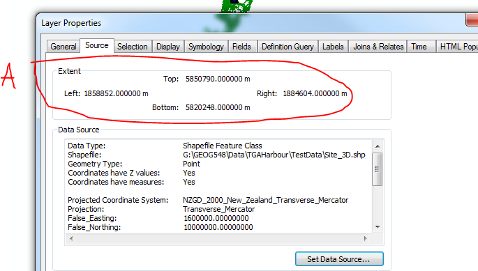
The properties of the missing layers show the extent in lat/long. The properties of the layers I can see (haven't changed the projections of) show the extent in meters.
I'm wondering if this could be the issue, and if it is how to change it. If its not this, what could it be? Whats the best way forward?
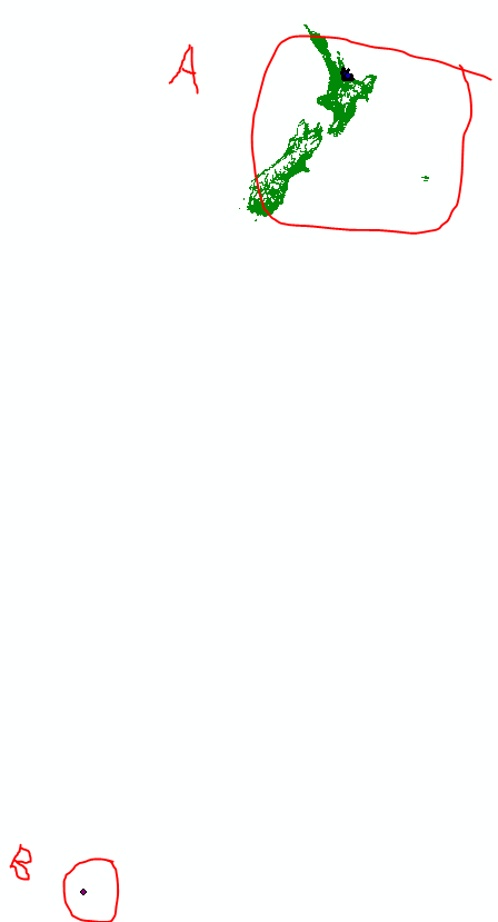
I have re projected (as per advice) and can now see my layers on the same page - but they still don't overlap. I suspect this is because of extents. The attached images will show where the layers of extent type A and B respectively are showing. Projecting has not changed this... is there a way to change it? Maybe try another co-ordinate system?
![Extent for layers in B - shows recognisable lat/long (175, 34[![][2]](https://i.sstatic.net/5dKyb.png) ]4
]4


