3

I have huge polygons (expanded on more than 25 degrees) with vertices positioned on degrees coordinates grid nodes on WGS84 CRS :

enter image description here

I'd like to calculate, in the most exact way, the area of this polygon. In my case I use the UTM42S CRS.

  1. In QGIS, I convert the polygon from WGS84 to UTM42S CRS
  2. Before I calculate the area, I display the degrees coordinates grid layer (WGS84) and my new polygon layer (UTM42S) with a project CRS set on UTM42S with the "on fly" option. We can see that the longer polygon line doesn't follow the grid line. It means that the area will be greater than the reality.

enter image description here

The only solution I have is to add other polygon vertices on grid nodes (when it's possible) on WGS84. Like that after the conversion to UTM42S strait lines will more follow the grid curve lines. Any ideas ?

Here are the polygons area into UM42S CRS :

FID area-1
0   9 213
1   2 692
2   8 271
3   39 649
4   273 653
5   55 684
3
  • There is no good or bad. What you are asking is completly dependend on what you need. What you want to do with those polygons? And therefore i think you don´t need to put both answers into the arena and ask for a poll. You decide by accepting the answer that worked for you. You already figured out the differences.
    – Matte
    Commented Oct 19, 2016 at 11:17
  • I'm sorry but I'm a newer. I have to improve the use of this fantastic help tool. If I use the @HDunn method, the areas really different. This areas will be used on official documents and if they're not exact, it can have serious consequences.
    – Cynthia
    Commented Oct 19, 2016 at 13:27
  • This is the "clothesline effect", see gis.stackexchange.com/q/444441/7505 Commented Aug 11 at 10:21

2 Answers 2

3

Is it about the calculated area or the view?

The calculated area should be nearly the same (on smaller extents up to a few hundred kilometers) as both are using nearly the same geoid (minimal difference between GRS 80 and WGS 84) for calculation. What you see on the screen is a matter of projection and does not have anything to do with the real area. When you try to get the same "view" in different projections (or in your case no projection vs mercator) you are creating entirely different polygons.

4
  • Thanks for proposition, additional precisions just added on the question. According to your explanation, why when I densify the polygon and turn the shape into UTM42S projection, the area is different ?
    – Cynthia
    Commented Oct 19, 2016 at 11:19
  • Area calculation after densification : FID area-2 0 9 206 1 6 576 2 8 271 3 39 452 4 286 616 5 47 001 The ratio between this 2 propositions : FID area-1 / area-2 0 0,999 1 2,443 2 1,000 3 0,995 4 1,047 5 0,844 What about you, which is the good way ?
    – Cynthia
    Commented Oct 19, 2016 at 13:24
  • I just realized the huge extent of your polygons. If i understand you correct your nodes have a distance of 1 degree, and i´m counting 14 in your picture. The utm projection for example is made for 6 degree wide zones and will have large distortions outside of that extent. For the calculation of the area on such large polygons i would stay with wgs 84.
    – Matte
    Commented Oct 19, 2016 at 13:53
  • Thanks for your reply. Effectively, It's an huge maritime area. My predecessor was convinced to have to use corresponding UTM projection ....
    – Cynthia
    Commented Oct 20, 2016 at 6:15
2

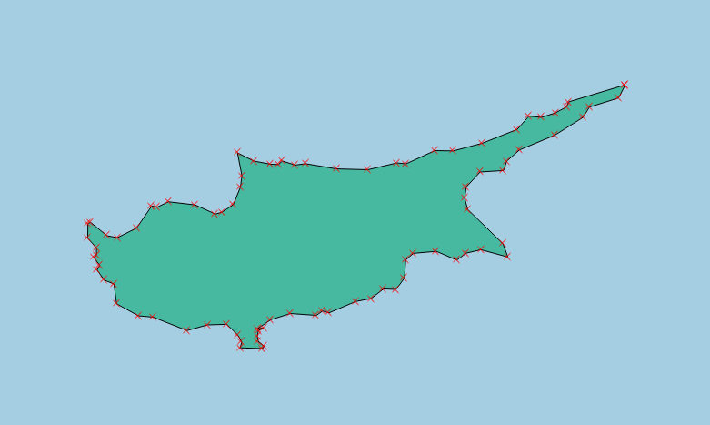
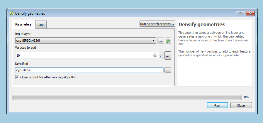
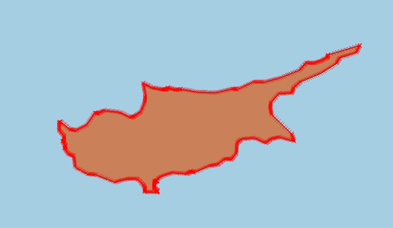
You can use densify geometries to add vertices at closer intervals on the original WGS 84 layer. In theory, this may reduce such errors that result from the projection, as each vertex will be transformed correctly, and the "line" segments in between will be smaller and less prone to errors.

Here's a simple example:

The vertices in the original layer: enter image description here

Adding vertices to each segment: enter image description here

And the result: enter image description here

2
  • Thanks for proposition, additional precisions just added on the question.
    – Cynthia
    Commented Oct 19, 2016 at 11:17
  • Hi, densify geometries is the solution, but how much is an open-question; and, after transforming, a simplification to use less disk space. The solution for the "clothesline effect" problem (as it was called) is at gis.stackexchange.com/q/444441/7505 Commented Aug 11 at 10:16

Your Answer

By clicking “Post Your Answer”, you agree to our terms of service and acknowledge you have read our privacy policy.

Not the answer you're looking for? Browse other questions tagged or ask your own question.