4

I am trying to create a GIS map that contains data for over 200 monitoring wells that are sampled 4 times a year. I would like to set up the GIS map so the attributes table for the well layer updates automatically when I update the excel spreadsheet that I would like to link to the well layer attributes. Is there an easy way to link an excel spread sheet to an attribute table so the attributes will update automatically when the excel file is updated. I found some information about this topic in the question pool, but didn’t find a clear solution.

I'm using Arcmap by Esri version 10.3?

3
  • What have you tried? Please edit your question to include the following: How are the table and map connected? Is this a join to a feature class, or a table of XY which is displayed as points? Or something different? What kind of changes are you making to the Excel table, and how do you want to see them in Arcmap?
    – Midavalo
    Commented Oct 19, 2016 at 19:13
  • 1
    I have posted this as a comment before, but if you use Access and insert your Excel table as a linked table, then add the table to ArcMap as a OLE database connection to the referenced table in Access you should get the magic you are looking for. I have even observed points shifting dynamically before I hit save in Excel... no locking issue the Excel.. Works really well.
    – Mike
    Commented Oct 19, 2016 at 20:38
  • @Mike that might be worth expanding (with some steps) into an answer
    – Midavalo
    Commented Oct 19, 2016 at 22:09

2 Answers 2

4

So I was wrong about the database connection thing, you can't see the linked table if you add the database that way. Works this way

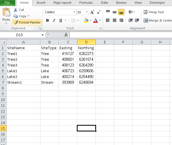
  1. Excel table saved as xls (xlsx not supported as linked table in an Access mdb)
    Create/Save your Excel Table as xls

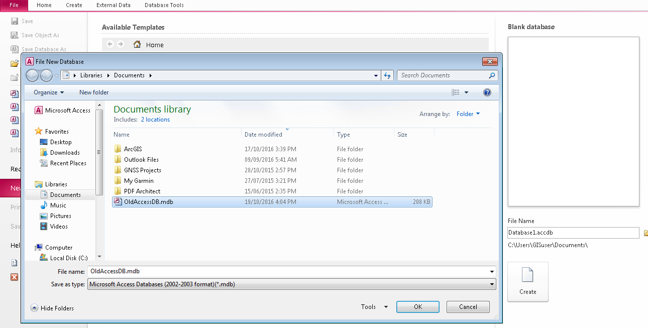
  2. Access database as mdb
    Old mdb type Access Database

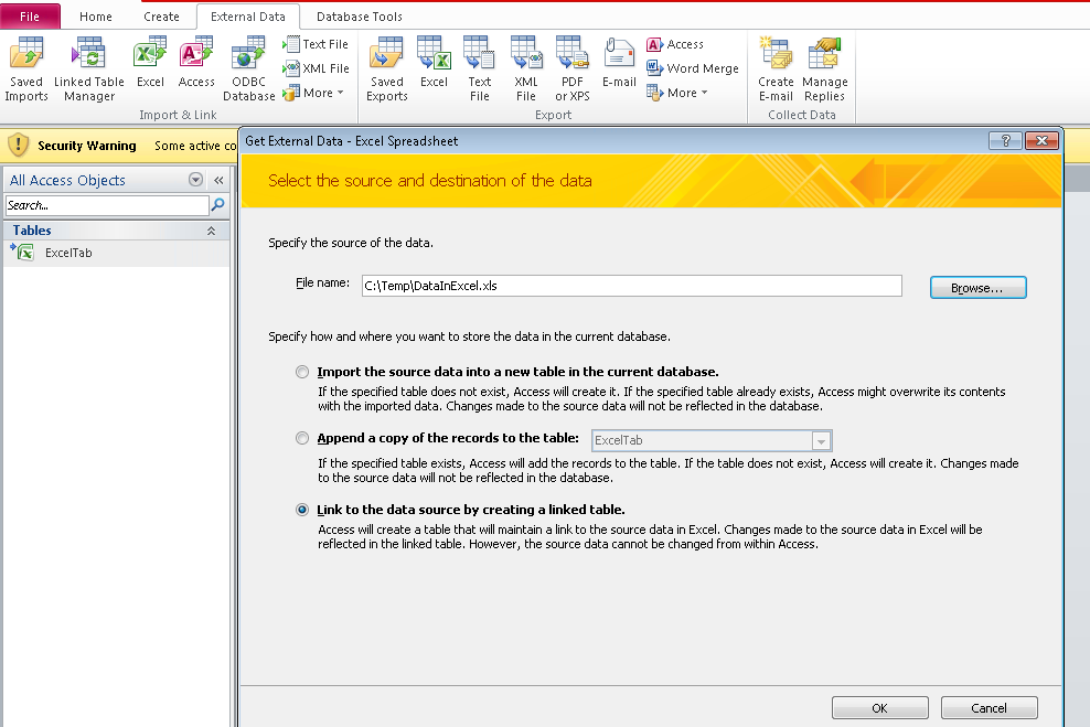
  3. Import Excel into Access files as a linked table
    Import Dialouge in Access

  4. Add data in Arcmap and browse to the mdb and add the table.

  5. Create event layer or joined feature

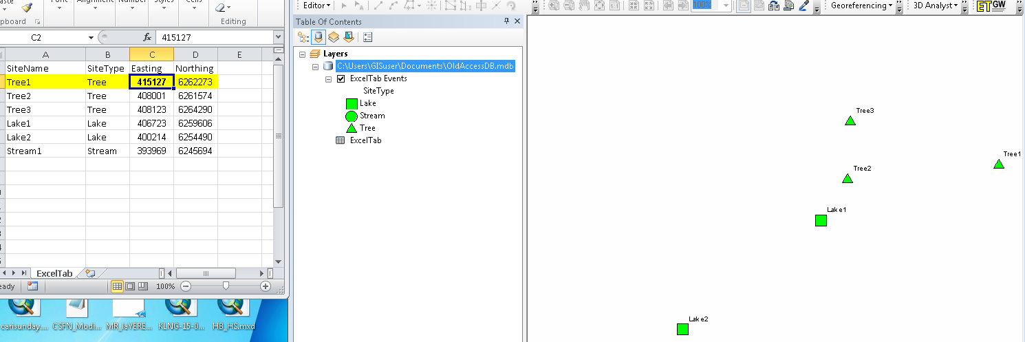
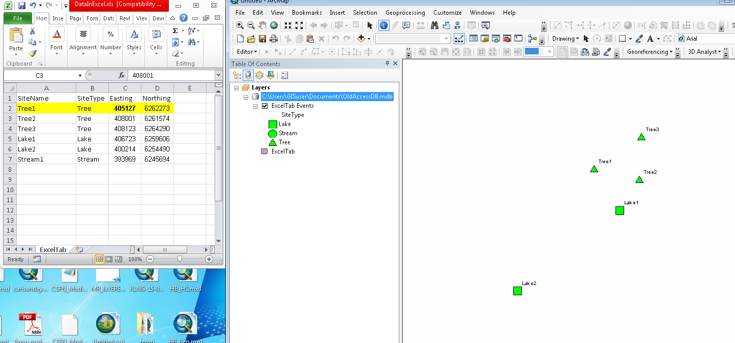
  6. Open the Excel at the same time as the map is open and make a live edit
    Excel and ArcMap together

  7. Hit refresh in Arcmap... hadn't even hit save in excel yet.. which is the magic part to me :)
    Tree1 coordinate shifted

Keep in mind that none of this is going to be supported functionality.. and it is using all old filetypes that are likely on their way out.

3
  • Thank You very much for the detailed instructions. I will try this out and report how it worked. tky
    – user70650
    Commented Oct 19, 2016 at 23:44
  • I was able to link the excel table to the Access data base, but for some reason I can't see the database file in ArcCatalog view.
    – user70650
    Commented Oct 21, 2016 at 15:14
  • Not sure why that would be. I don't know why you would care if you can see the table in Catalog, but I assume this means you can't see the table by browsing into the Access mdb from ArcMap "Add Data"? You made an Access "mdb" file and not the newer "accdb" Access filetype?
    – Mike
    Commented Oct 21, 2016 at 16:37
0

I also work in the environmental field. In my experience, arcmap fights you every step of the way when trying to make dynamic maps that update automatically with new data. You might want to check out QGIS, which has an ability an option to "watch file" when importing a .csv. This with the "EasyCustomLabeling" plugin + a join on the label layer and the "watched" cvs file led to a pretty robust solution where documents update automatically.

Your Answer

By clicking “Post Your Answer”, you agree to our terms of service and acknowledge you have read our privacy policy.

Not the answer you're looking for? Browse other questions tagged or ask your own question.