2

I'm working with a natural vulnerability research, using a methodology that interpolate data from a high number of wells (around 600) to create a map of the vulnerability of the area.

Following the methodology, I intepolate the data using Kriging.

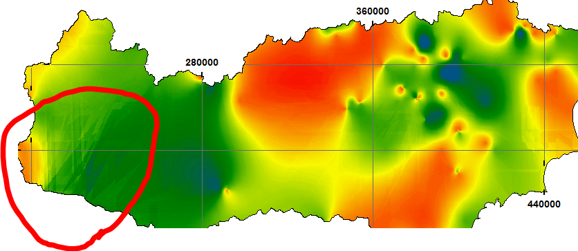
Since I have and region with almost no wells in my study area, I would like to know if there is any way get around this situation and don't get a map with the kriging error like on the image.

enter image description here

I'm using ArcGis 10.3.1, the interpolation was made on Raster Tool from Surfer.

1 Answer 1

3

Assuming this is with just the standard "Kriging" tool of the Spatial Analyst, honestly, the tools in the Interpolation toolset of Spatial Analyst just don't cut it... They lack all kinds of vital function like exploratory data analysis, transformations, cross validation etc.

If you need to deal with potentially problematic datasets, I really recommend you to have a look at the Geostatistical Analyst and its far more sophisticated interpolation options, or one of the other specialized software packages out there.

These tools should also be able to tell you if interpolation across the entire surface is actually sensible, or if errors are to high.

1
  • Thanks for the advice. Actually I used a Raster Tool From Surfer - Golden Software because I didn't got a good result with esri tools for interpolation.
    – apatons
    Commented Feb 12, 2017 at 0:10

Your Answer

By clicking “Post Your Answer”, you agree to our terms of service and acknowledge you have read our privacy policy.

Not the answer you're looking for? Browse other questions tagged or ask your own question.