I have a geoTiff file with the following gdalinfo output:
Driver: GTiff/GeoTIFF
Files: original.tif
Size is 48377, 15906
Coordinate System is:
GEOGCS["WGS 84",
    DATUM["WGS_1984",
        SPHEROID["WGS 84",6378137,298.257223563,
            AUTHORITY["EPSG","7030"]],
        AUTHORITY["EPSG","6326"]],
    PRIMEM["Greenwich",0],
    UNIT["degree",0.0174532925199433],
    AUTHORITY["EPSG","4326"]]
Origin = (25.668509000000000,42.104685623790893)
Pixel Size = (0.000395841574135,-0.000395841574135)
Metadata:
  AREA_OR_POINT=Area
  DataType=Generic
Image Structure Metadata:
  COMPRESSION=LZW
  INTERLEAVE=BAND
Corner Coordinates:
Upper Left  (  25.6685090,  42.1046856) ( 25d40' 6.63"E, 42d 6'16.87"N)
Lower Left  (  25.6685090,  35.8084295) ( 25d40' 6.63"E, 35d48'30.35"N)
Upper Right (  44.8181368,  42.1046856) ( 44d49' 5.29"E, 42d 6'16.87"N)
Lower Right (  44.8181368,  35.8084295) ( 44d49' 5.29"E, 35d48'30.35"N)
Center      (  35.2433229,  38.9565576) ( 35d14'35.96"E, 38d57'23.61"N)
Band 1 Block=128x128 Type=Byte, ColorInterp=Gray
  NoData Value=15
  Image Structure Metadata:
    NBITS=4
I want to reproject it to EPSG:3857 for native (fast) rendering on Geoserver. This is the command I use to reproject it:
gdalwarp -t_srs EPSG:3857 -co 'TILED=YES' -co 'BLOCKXSIZE=256' -co 'BLOCKYSIZE=256' -ts 48377 15906 original.tif projected.tif
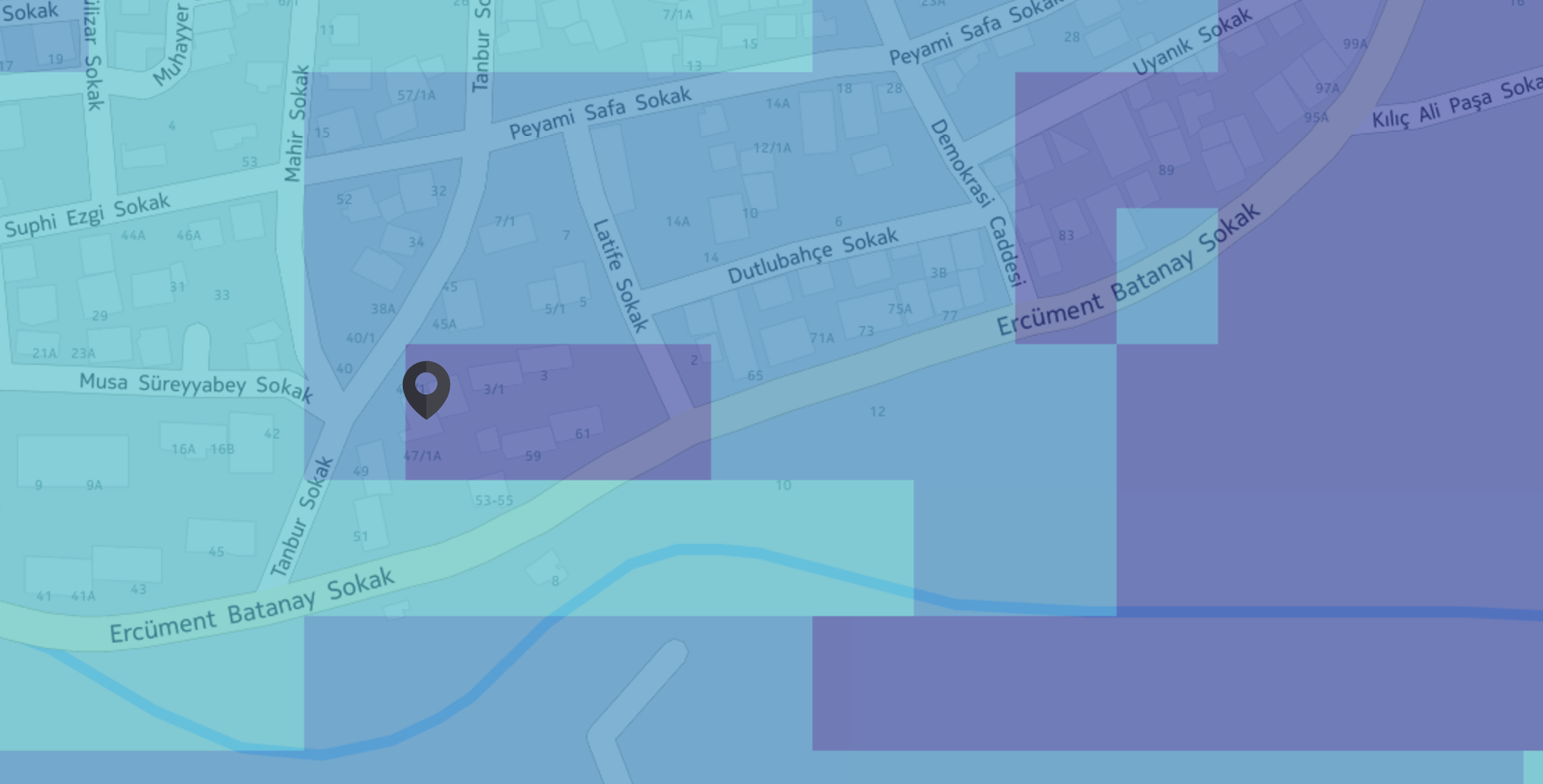
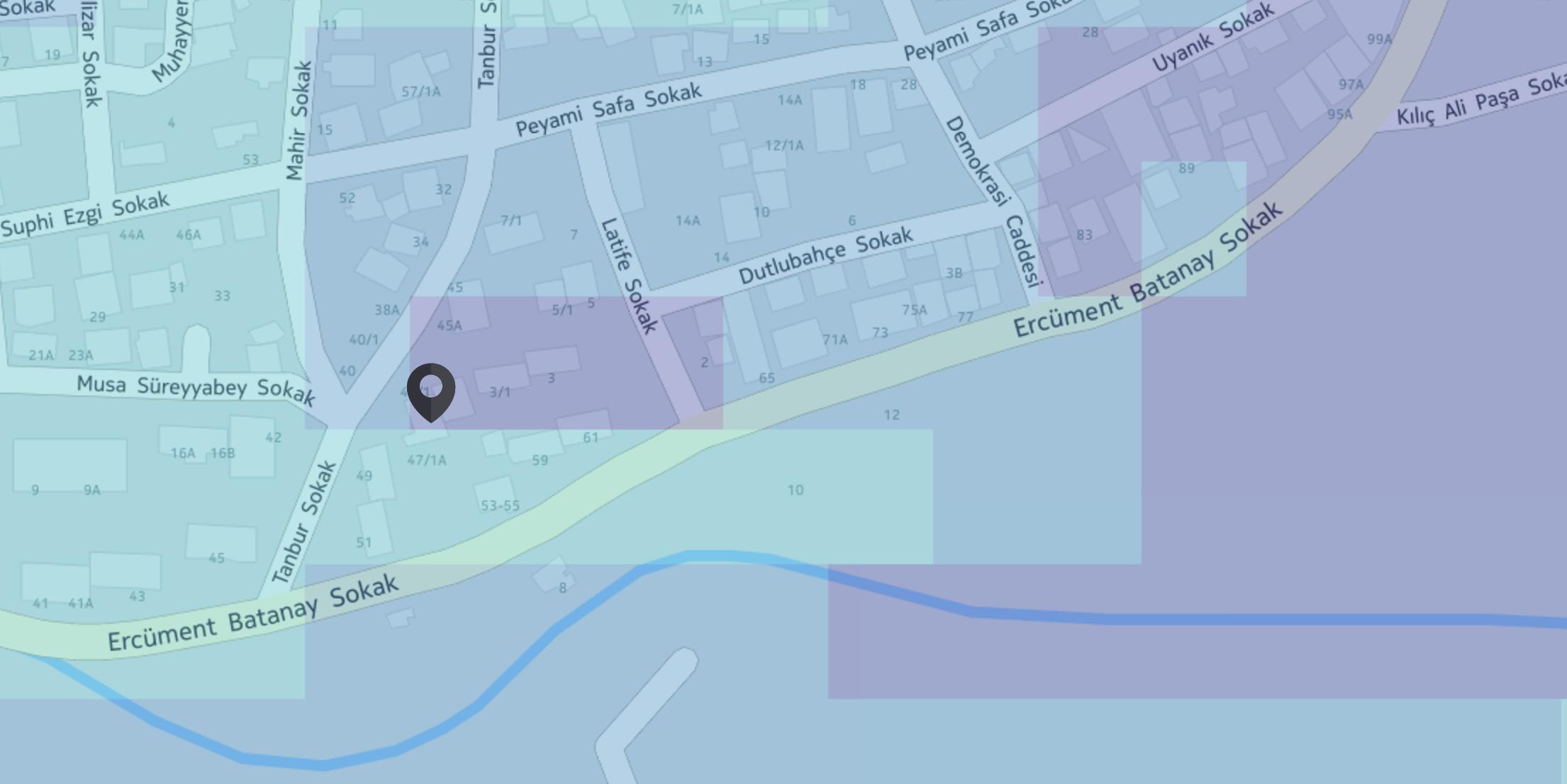
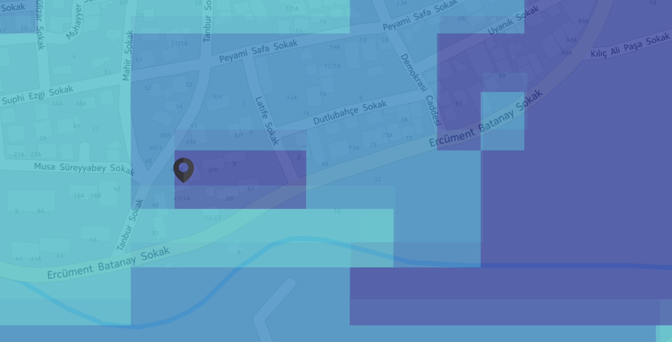
Below, you can see the original, projected and both tiffs on top of each other:
Original:
Projected:
Both:
As you can see the projected raster is not aligned with the original one.
I have read that tapcan be used to align pixels, and tried this:
gdalwarp -t_srs EPSG:3857 -co 'TILED=YES' -co 'BLOCKXSIZE=256' -co 'BLOCKYSIZE=256' -tap -tr 8 8 original.tif projected.tif
Now this outputs a tiff file with a very little shift (about 2m) which I am ok with. But the processing is very slow and the resulting file is 30GB.
Giving large tr values such as -tr 40 40, fixes the slow processing problem, but the output tiles are no longer have the same value as the original ones because of the resampling I guess.
I also want to note that, tiles from the above picture are requested using EPSG:3857 srs from Geoserver. Geoserver can project native EPSG:4326 tiles to EPSG:3857 on the fly with accurate precision, but I can not produce the same result with gdal.
EDIT
These are some screenshots for different target resolutions:





gdalwarp -t_srs EPSG:3857 -co 'TILED=YES' -co 'BLOCKXSIZE=256' -co 'BLOCKYSIZE=256' original.tif projected.tifwithout target size. See if pixels are shifted and tell us what is the pixel size when GDAL can decide it.