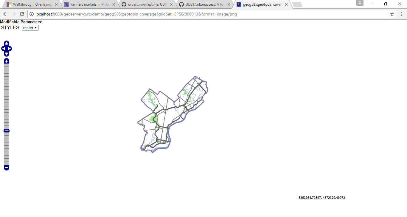
I am doing a walkthrough using OpenLayers through a UPENN course where the students are instructed to point to a school sponsored url that hosts a repository for their work. Their respective repositories have tiled images for them to use as a basemap. Since I'm not a UPENN student I'm trying to get the service to point to localhost through a GeoServer portal:
http://localhost:8080/geoserver/gwc/demo/geog585:geotools_coverage?gridSet=EPSG:900913&format=image/png

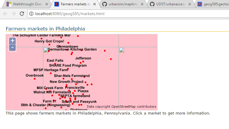
However, when I open the html page in my browser I get a a pinkish background with broken image icons:
Here is the complete code for the html page:
<!DOCTYPE html>
<html>
  <head>
    <meta http-equiv="Content-Type" content="text/html; charset=utf-8">
    <meta name="viewport" content="width=device-width, initial-scale=1.0, maximum-scale=1.0, user-scalable=0">
    <meta name="apple-mobile-web-app-capable" content="yes">
    <title>Farmers markets in Philadelphia</title>
    <link rel="stylesheet" href="http://cdnjs.cloudflare.com/ajax/libs/openlayers/2.12/theme/default/style.css" type="text/css">
    <link rel="stylesheet" href="style.css" type="text/css">
    <script src="http://cdnjs.cloudflare.com/ajax/libs/openlayers/2.12/OpenLayers.js"></script>
    <script type="text/javascript">
    var fromProjection = new OpenLayers.Projection("EPSG:4326"); // WGS 1984
    var toProjection = new OpenLayers.Projection("EPSG:900913"); // Spherical Mercator Projection
    var map;
    function init() {
        map = new OpenLayers.Map("map", {projection:toProjection});

        // Add the tiled layer
        var tiles = new OpenLayers.Layer.XYZ(
           "PhillyBasemap",
           [
            "http://localhost:8080/geoserver/gwc/demo/geog585:geotools_coverage?gridSet=EPSG:900913&format=image/png"
           ],
           {
            attribution: "Data copyright OpenStreetMap contributors",
            sphericalMercator: true,
            wrapDateLine: true,
            numZoomLevels: 18
           }
         );
        map.addLayer(tiles);
        // Add the WMS
        var layer = new OpenLayers.Layer.WMS(
          "WMS", "http://localhost:8080/geoserver/geog585/wms",
          {
            LAYERS: 'geog585:FarmersMarkets',transparent: true
          },
          {
            singleTile:true,
            isBaseLayer: false
          }
        );
        map.addLayer(layer);
        // Center the map
        map.setCenter(new OpenLayers.LonLat(-75.145, 40).transform(fromProjection,toProjection), 11);
        // Configure the query on click
            var info = new OpenLayers.Control.WMSGetFeatureInfo({
              url: 'http://localhost:8080/geoserver/geog585/wms',
              title: 'Identify features by clicking',
              queryVisible: true,
              infoFormat: "application/json",
              eventListeners: {
                getfeatureinfo: function(event) {
                  // Read and parse the query response, if there is one
                  var response = JSON.parse(event.text);
                  if(response.features.length !== 0){
                    var returnedFeature = response.features[0];
                    // Configure the popup
                    map.addPopup(new OpenLayers.Popup.FramedCloud(
                      "marketInfo",
                      map.getLonLatFromPixel(event.xy),
                      null,
                      "<b>" + returnedFeature.properties.NAME + "</b><br />" + returnedFeature.properties.ADDRESS,
                      null,
                      true
                    ));
                  }
                }
              }
            });

            map.addControl(info);
            info.activate();
        }
    </script>
</head>
<body onload="init()">
    <h1 id="title">Farmers markets in Philadelphia</h1>

    <div id="map" class="smallmap"></div>

    <div id="docs">
        <p>This page shows farmers markets in Philadelphia, Pennsylvania. Click a market to get more information.</p>
     </div>
   </body>
</html>
Can someone tell me what I'm missing in the tiles variable?
