2

I have made up a number of maps in QGIS in order to complete a small mapping project in North West Spain. The data was downloaded from IGN:

The vector files downloaded were from: centrodedescargas.cnig.es/CentroDescargas/index.jsp , from the 1:25,000 vector maps in .dgn format.

These are referenced to CRS system ETRS89 30N. I've attached an example of one of the maps. enter image description here
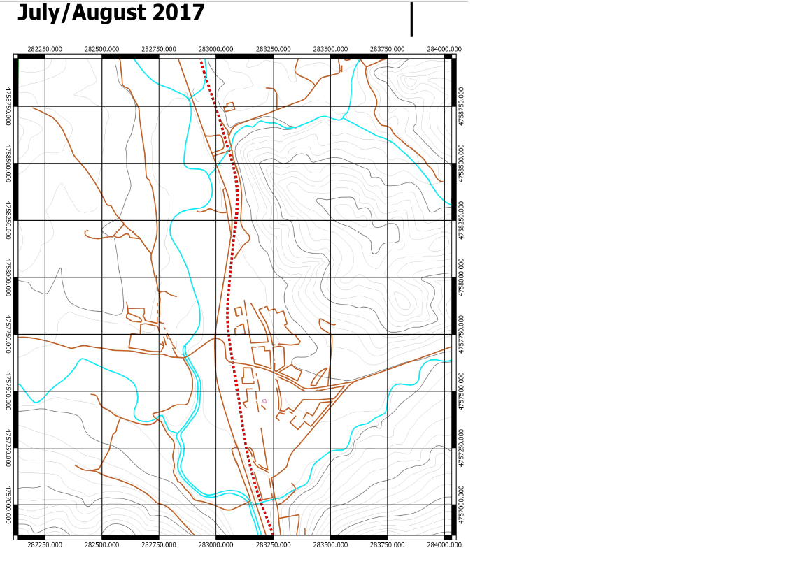
I have a few questions (I'm not very experienced in GIS so please bear with me...)

  • How can I change the grid system on my map to match with WGS84 when my layers are in ED50 30N and actual grid is in ETRS89 30N, ensuring everything is properly calibrated and matched up?

  • Can I use British grid on my Garmin Etrex 10 (handheld GPS) in Spain, considering they're both in ETRS89?

1 Answer 1

1

I would recommend first converting those microstation dgn files to esri shapefiles and switch them to EPSG:4326 while you're at it.

GDAL can accomplish that for you. The following command will take an input .dgn file with EPSG:25830 projection and convert it to shapefiles using WGS84 for use on your GPS tracker.

MicroStation files appear to have multiple geometry types while shapefiles can only hold one per shapefile, so you'll need to use a bit of filtering and create more than one shapefile like this:

ogr2ogr -where "OGR_GEOMETRY='Point'" -f "ESRI Shapefile" -t_srs EPSG:4326 -s_srs EPSG:25830 output_point.shp input.dgn

ogr2ogr -where "OGR_GEOMETRY='LineString'" -f "ESRI Shapefile" -t_srs EPSG:4326 -s_srs EPSG:25830 output_linestring.shp input.dgn

ogr2ogr -where "OGR_GEOMETRY='Polygon'" -f "ESRI Shapefile" -t_srs EPSG:4326 -s_srs EPSG:25830 output_polygon.shp input.dgn

There are many ways to install GDAL depending on your operating system. I prefer to use it within a Python virtual environment for example, but FWTools is normally a nice choice for Windows or Linux machines. I haven't used it on a mac but this other gis.SE answer looks promising.

1
  • FWTools is inactive since many years, and does not contain latest GDAL/PROJ.4 versions. I suggest gisinternals.com/release.php instead. For Ubuntu, you may look into the ubuntugis ppa.
    – AndreJ
    Commented Jul 4, 2017 at 15:08

Not the answer you're looking for? Browse other questions tagged or ask your own question.