1

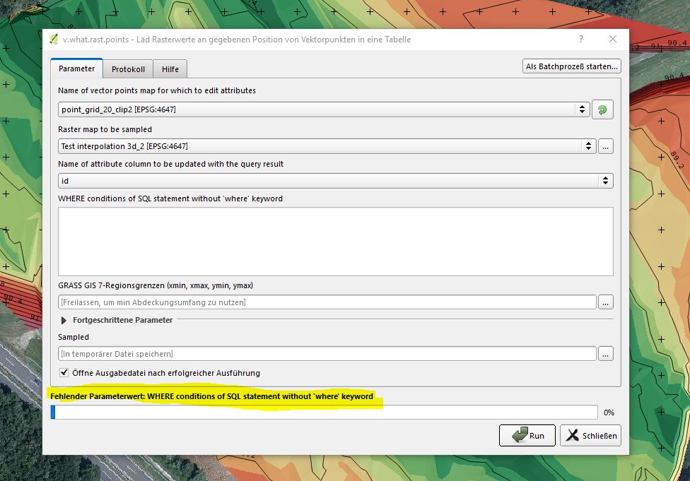
In order to extract raster values in QGIS I want to use the grass command v.what.rast.points in the toolbox. But the process won't start - it claims: "Where conditions of SQL statement without 'where' keyword". What am I supposed to fill in?

Another problem: I created an extra attribute column for the extracted values to be stored in (type: string; length: 7) , but it won't show in the selection tab of the v.what.rast.pints tool. Only the ID field can be chosen. enter image description here
1 Answer 1

1

The where parameter lets you specify which field and values you want to use in the calculation.

For example, if you have an id field and you only want to retrive the values for those points with an id less than 50, then you would use:

id < 50

If you want to use all values in a field (i.e. all features), you can just type in the field name:

id

In terms of the fields, it is mentioned in the GRASS v.what.rast help page that the field type must be numeric:

  • Integer
  • Float
  • Double

So you will need to create a numeric field, not string, in order to store the results.

2
  • 1
    Thanks a lot, Joseph. It worked very well. But only after I copied the files (shapefile and tiff) from the folder it was in originally to another one. Before I had an error because it couldn't find the files. Do you know if it is a problem for Grass and Saga tools when the folder the data is stored in or the file's names contain letters like "ü" "ö" "ß"etc.? Commented Aug 24, 2017 at 10:49
  • 1
    @Vogon_Jeltz - Most welcome! And yes, very likely. There have been a number of questions asking this here on GIS:SE where the main solution was to make sure the file names (and username) did not include those sort of characters :)
    – Joseph
    Commented Aug 24, 2017 at 10:50

Your Answer

By clicking “Post Your Answer”, you agree to our terms of service and acknowledge you have read our privacy policy.

Not the answer you're looking for? Browse other questions tagged or ask your own question.