1

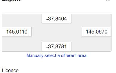
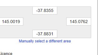
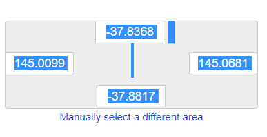
I created an export in OpenStreetMap for an address in Melbourne, Australia with a zoom level of 14: http://www.openstreetmap.org/export#map=14/-37.8593/145.0390. The export coordinates changed depending on whether I view it in Firefox, Chrome or Microsoft edge. Why does this variation happen?

I assumed that the export would be the same given the same coordinates and the same map size/zoom level (i.e. 14). Is there a way to achieve that?

  • Chrome:

    export in chrome

  • FireFox

    export in firefox

  • Edge

    osm export in microsoft edge

2
  • 2
    Is it because your browser windows are a different size? If I resize my Firefox browser, the coordinates change - they have to, because the exported area fills the browser window...
    – Spacedman
    Commented Oct 14, 2017 at 15:49
  • you could also try full-screen mode in the browser, usually f11 to toggle (works in FF and Chrome, not sure about Edge).
    – Steven Kay
    Commented Oct 14, 2017 at 16:31

1 Answer 1

5

After hitting the "Export" button, the download URL to actually fetch the .osm file is like this:

http://www.openstreetmap.org/api/0.6/map?bbox=144.9947%2C-37.8814%2C145.0832%2C-37.8372

so It looks like you could construct that with the specific bounding box coordinates you want. The view on the web page is influenced by the size of your browser window, which might be why you see different bounds in different browsers.

Your Answer

By clicking “Post Your Answer”, you agree to our terms of service and acknowledge you have read our privacy policy.

Not the answer you're looking for? Browse other questions tagged or ask your own question.