I'm new to mapping concepts and software.
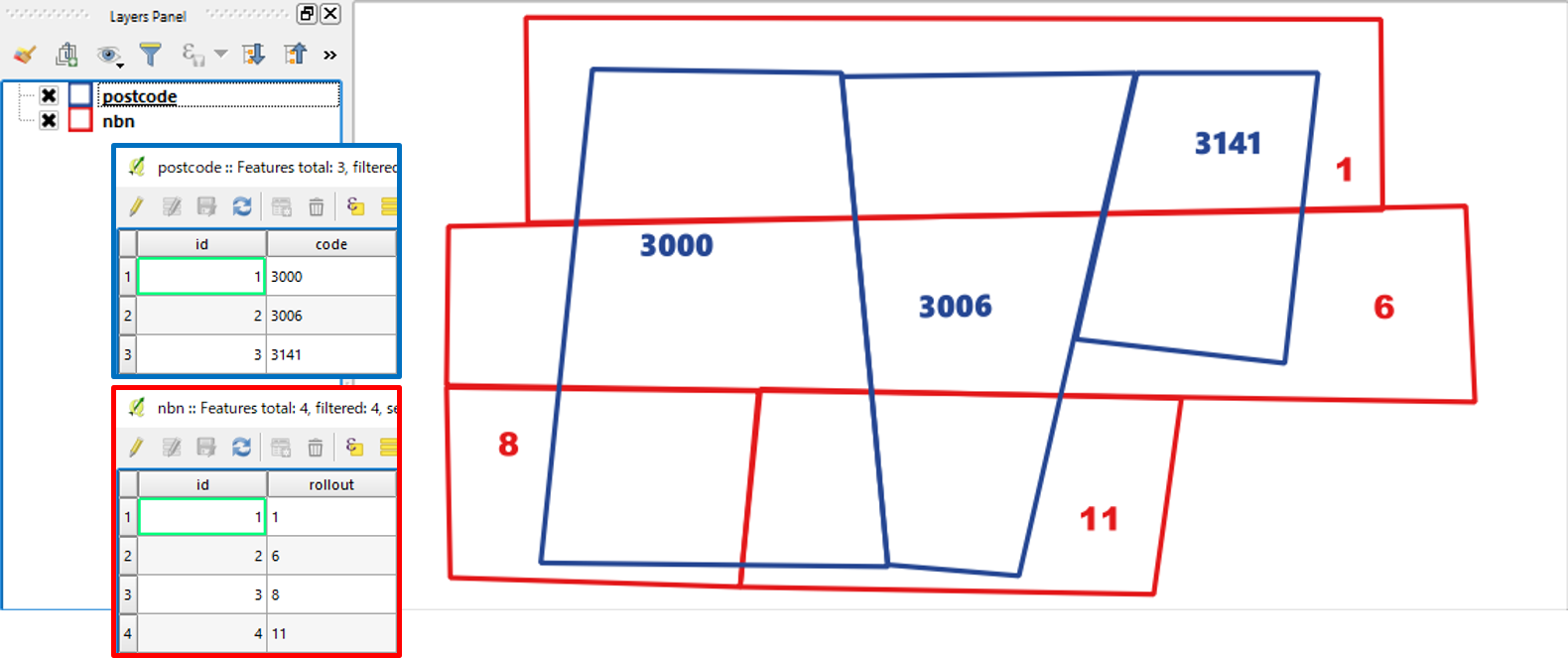
I need to report on the intersecting area of postcode polygons and NBN Rollout areas. So postcode 3000 has 3 units of area in rollout region 1 and 6 units of area in rollout region 2.
Postcode polygons come in an ESRI Shapefile. NBN Rollout regions come in a KML file.
I've loaded both into QGIS, saved them into a new file with CRS = EPSG 4326 then loaded these new files. Now the layers have the same CRS.
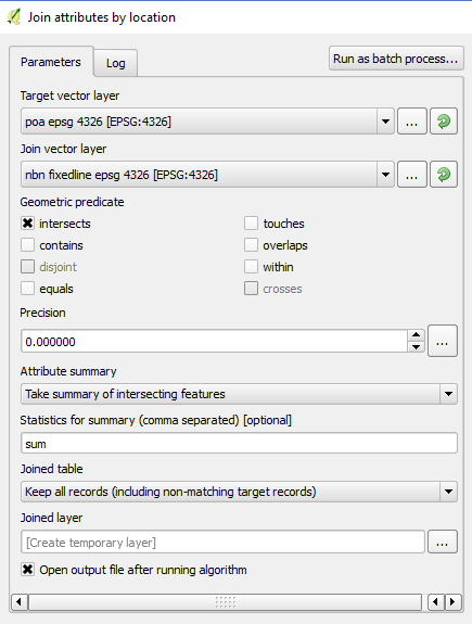
I then went to Vector > Data Management Tools > Join attributes by location.
Here are the settings I've selected:
That runs for a few minutes before throwing this error:
The log messages panel gives the following log entry:
Uncaught error while executing algorithm Traceback (most recent call last): File "C:/PROGRA~1/QGIS2~1.18/apps/qgis/./python/plugins\processing\core\GeoAlgorithm.py", line 203, in execute self.processAlgorithm(progress) File "C:/PROGRA~1/QGIS2~1.18/apps/qgis/./python/plugins\processing\algs\qgis\SpatialJoin.py", line 158, in processAlgorithm outFeat.setGeometry(f.geometry()) TypeError: QgsFeature.setGeometry(QgsGeometry): argument 1 has unexpected type 'NoneType'
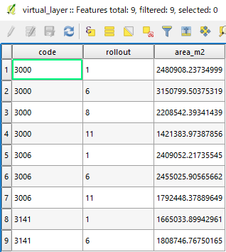
The final output I want to see is something like this:
postcode    rollout_region  area
3000        1               27
3000        2               44
3141        4               94
3141        6               46
3006        8               70
3006        9               41
3006        11              38
if the problem can be solved more easily in some other open source software I'm happy to try that.

