I'm looking for a guide to bringing files into QGIS so that the scale bar in print composer reads accurately. At the moment the files I'm bringing in are Geotiff and DEM. I know this has something to do with CRS. They are in EPSG:4326,WGS84.
-
1Welcome to GIS Stack Exchange, Please take the tour if you haven't already. At the moment your question is a too vague to get a good answer. Providing an example of the data you wish to import or screen shots of the problem would be helpful.– RoperMapsCommented May 1, 2018 at 10:29
-
What CRS is your data in currently?– nmtokenCommented May 1, 2018 at 15:11
-
Thanks for your comments - but that first answer was perfect!– PaulCommented May 1, 2018 at 15:50
1 Answer
The Coordinate Reference System you use, also known as CRS, is probably not the correct one to measure distances on. If you want to change this correctly, you might need to know a little bit more background information.
Some well known systems are:
- WGS 84 (EPSG:4326), a geodetic (sphere) system, measures in degrees north and east. Coordinates from GPS are in this system.
- WGS 84 / Pseudo-Mercator (EPSG:3857), a projected (flat) system, measures in meters easting and northing (X,Y).
Measuring distances in WGS 84 will give results in degrees, which are not great to work with.
The Pseudo-Mercator projection is created to visualize our not so flat world on a flat map using square tiles. Google Maps, Open Streetmap, etc. As a flat piece of paper doesn't fit around a football without folding it, you can imagine this is not the correct system to measure distances on:
Uses spherical development of ellipsoidal coordinates. Relative to WGS 84 / World Mercator (CRS code 3395) errors of 0.7 percent in scale and differences in northing of up to 43km in the map (equivalent to 21km on the ground) may arise.
To overcome this problem there are a lot of projected systems which cover smaller pieces of the world.
So, if you know the CRS your data is in and what projected CRS the data is on, you can reproject or transform the data to the projected CRS and measure more correct distances.
- Find the current CRS the dataset is on.
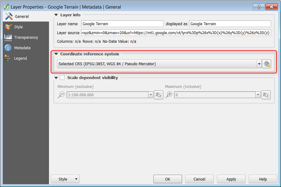
In QGIS, right click the layer, hit properties. Check the tab General.
 That was easy. Looks like Pseudo-Mercator to me.
- Find a proper projected CRS.
In a browser, hit http://epsg.io and hit the name of the country the data is in. In my case, Netherlands. Hit Projected to filter only projected systems, choose one of your liking, in this example Amersfoort / RD New (EPSG:28992).
Important: Double check if your data fits in the extends of the system. Measuring outside the system technically works but the results will be off without warnings.
- Change the Project CRS to the projected system.
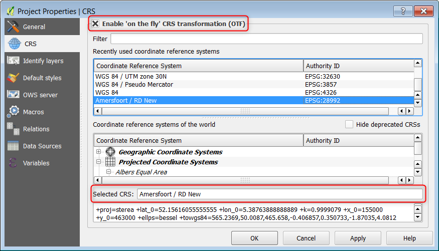
In QGIS, click Project, Project Properties... tab CRS. Search (use the EPSG code) and select the correct CRS.
 If you have layers on other CRS's, mark "Enable 'on the fly' CRS transformation (OTF)". This way the data will be reprojected to the project CRS while panning and zooming. This will hurt your performance. Reprojecting the data (Processing Toolbox, Reproject Layer) will fix this.
