GGRS87 (EPSG:2100) is the projection system for Greece. But there is also another projection system which caters for a complex of islands (Kastellorizo, etc) which are located east form Greece (near Turkey). I have created this new projection with the following parameters (+proj=tmerc +lat_0=0 +lon_0=27 +k=0.9996 +x_0=500000 +y_0=0 +ellps=GRS80 +towgs84=-199.87,74.79,246.62,0,0,0,0 +units=m +no_defs).
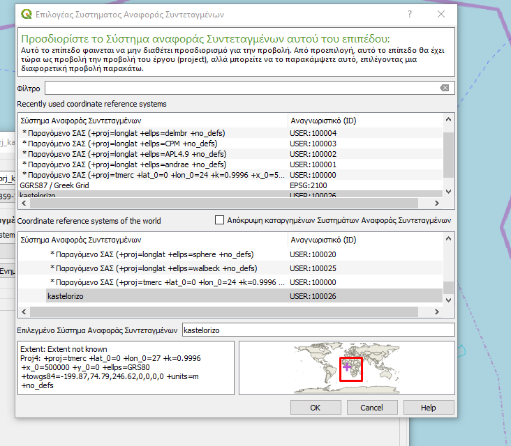
I have digitized some polygons on these islands with the help of some orthophotos. However, these orthophotos were not on the correct location. They are inside the extent of the area for GGRS87 and not near Turkey. I saved this shapefile to the new projection. The map of the extent of the CRS for the shapefile shows that the area of the projection system is located on the west side of Africa.
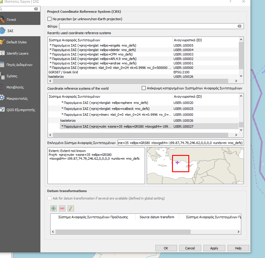
 On the contary, the map of the extent of the CRS for the whole project shows that the area of the projection system is near Turkey (which is the correct location).

How is this possible? Has the fact that I did not determine the extent when I created the new projection played a role in it? In addition you can download the polygon shapefile here.

+lon_0=30instead of 27. An offset of about 300m remains though.