I have a set of addresses in Belgium in Excel and I would want to geocode/transform them in coordinates in order to be able ta visualize them in QGIS 3.4. Does someone know how I could do?
2 Answers
There is a QGIS plugin called MMQGIS that has a function to geocode a CSV file using either OpenStreetMap/Nominatim or Google (if you have a Google API key).
For QGIS versions QGIS 3.20 and higher
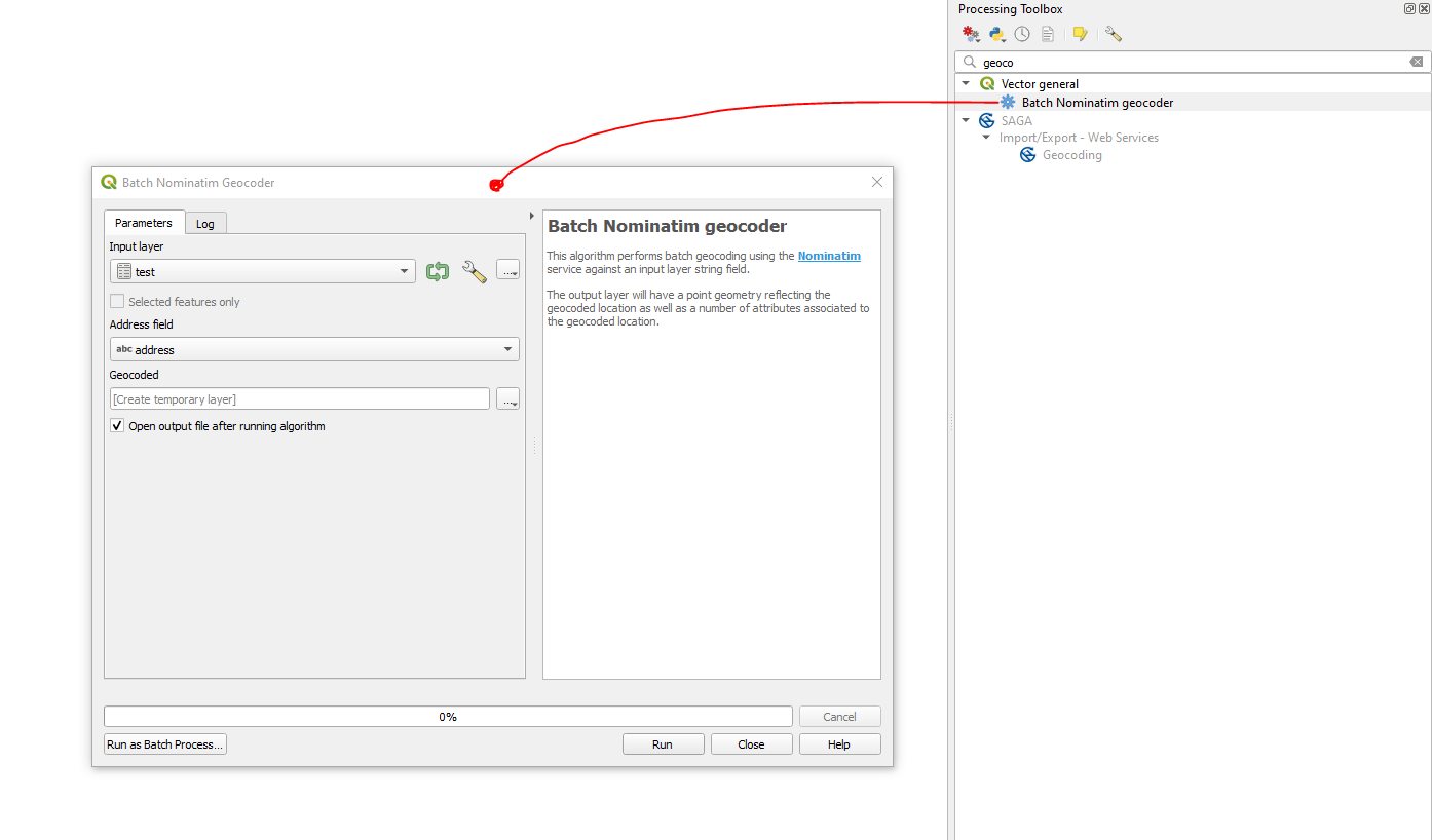
Starting from QGIS 3.20 it is possible to geocode addresses to coordinates by means of the native tool "Batch Nominatim geocoder", can be found under Vector General in the Processing Toolbox (Ctrl+Shift+T).
Step 1. Prepare your input CSV file which includes an address field i.e. is a concatenation of fields e.g. street, house number, postal code, city, state, country. (Some attributes are optional)
Let's assume there is a CSV file called 'test.csv', see image below.
Step 2. Drag&Drop the CSV file into QGIS. Make sure the right encoding was chosen i.e. UTF-8
Step 3. Apply the "Batch Nominatim geocoder" and press Run
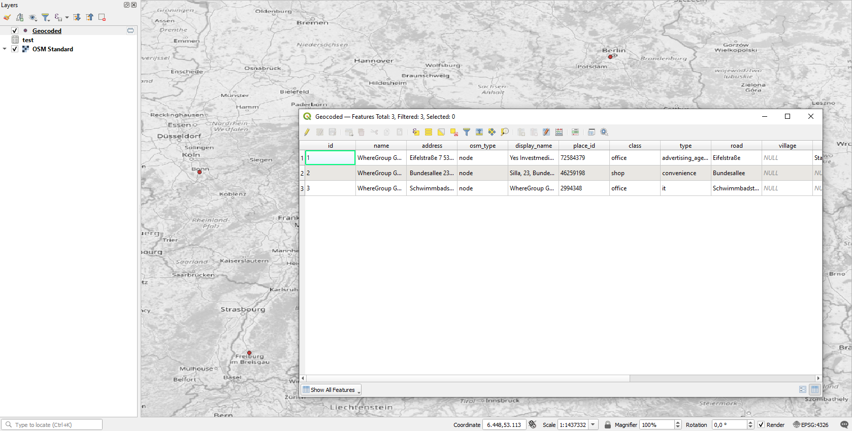
Step 4. Get the final output


