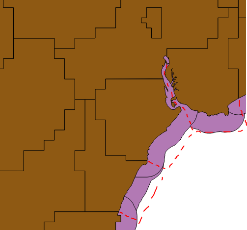
How can I achieve something similar to the below image? (Apologies for the crudely drawn diagram) Either in QGIS or PostGIS.
I have a series of station grounds and I want to retain the inner boundaries, but I want the coastline to buffer out 1 mile (distance for example, could be any distance). Also I want to split an estuary equidistant between polygons.

