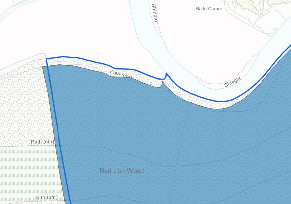
I've got a vector layer in my project which isn't aligned with the rest of the project (see attached JPEG). These are work files so I'm not sure when they were created or how they might have been messed with since they were created. We moved from ArcGIS to QGIS a couple of years ago.
The infilled blue vector layer is the one I need to move, slightly north and east, so that it correlates to the blue line (also a vector). All layers (and the project) are currently in EPSG:27700 - OSGB 1936.
If I need to create a new CRS based on OSGB 1936 and give it some new parameters, then how would I go about this?
Further information: This is on Exmoor in SW England, and the data is uniformly almost exactly 8m out to the SW point to point - i.e I need to shift it 8m NE.

