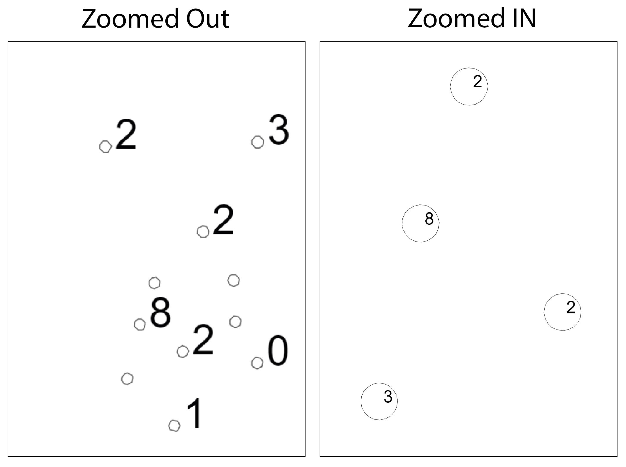
I want to export a map using QGIS2WEB which mostly works fine apart from labels. I have some numbers I want to display inside circles. I have tried all the settings I can think of but I can't get the web output to scale the fonts when I zoom in and out. I've tried setting the size of the labels using mm, points, map units, meters at scale, inches etc. When I zoom in and out on the WebMap (in Chrome or IE) the circles scale perfectly but the font size of the label doesn't scale. This means the labels will not stay inside the circles and appear too big or too small depending on the zoom level I'm on.
Specifying the size of points an svg symbols using map units works as as would like but label font size doesn't.
I have also tried editing the the .js and .css output from web2map but it's minified and virtually impossible to follow the code and find out whats happening.
I'm using Qgis 3.12.0


index.htmlforbindTooltip, and you will see the font label properties. That said, you'll need to rewrite the whole tooltip bit to call a function on zoom, something like this: stackoverflow.com/questions/47943315/…