I have a CTX mosaic for a base layer in my project. However, I am running into trouble overlaying HiRISE images over it. HiRISE final products should be georeferenced, but they just do not fall into place. I tried the manual georeferencing tool in QGIS to fix it but it also doesn’t work. An example of a HiRISE image is https://hirise-pds.lpl.arizona.edu/PDS/RDR/ESP/ORB_036900_036999/ESP_036925_1985/
2 Answers
I had the same problem. The inconvenient is that QGIS seems that is not able to understand correctly the projection information stored on the .jp2 image files. I recommend you to follow these steps:
(This worked on QGIS 3.10 A Coruña)
- Open an empty QGIS project file.
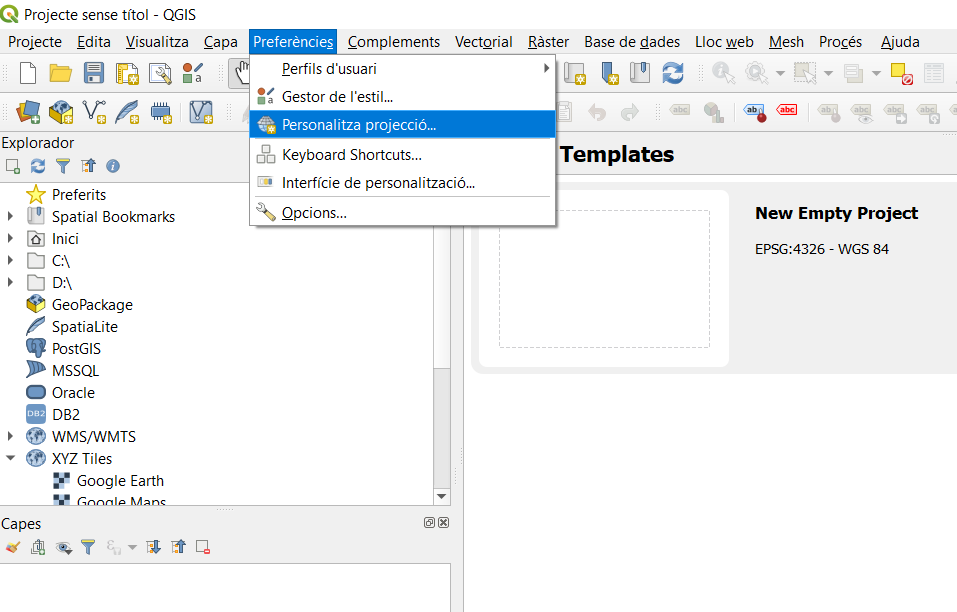
- Create a new projection by going to "preferences" -> "personalize projection".

- Go to spatialreference.org to search the projections used for Mars.
- The projection usually used by NASA and the USGS for Mars is the IAU2000:49910: Mars Equidistant Cylindrical. We should add this projection on QGIS.
- Click on the IAU2000:49910 and then click on "Well Known Text as HTML".
- Copy that text, which should be:
PROJCS["Mars_Equidistant_Cylindrical", GEOGCS["Mars 2000", DATUM["D_Mars_2000", SPHEROID["Mars_2000_IAU_IAG",3396190.0,169.89444722361179]], PRIMEM["Greenwich",0], UNIT["Decimal_Degree",0.0174532925199433]], PROJECTION["Equidistant_Cylindrical"], PARAMETER["False_Easting",0], PARAMETER["False_Northing",0], PARAMETER["Central_Meridian",0], PARAMETER["Standard_Parallel_1",0], UNIT["Meter",1]]
This code defines the ellipsoid and the projection for Mars.
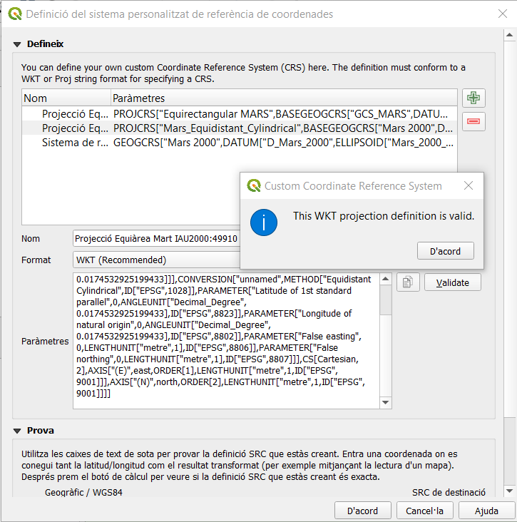
- Return to QGIS and paste on the opened window and give it an easy name to identify:
 (Remember the format must be: WKT - Welll Known Text)
 - Load the ESP_036925_1985_(COLOR/RED) images. Ignore possible errors about projections.
- Now change the project projection to IAU2000:49910.
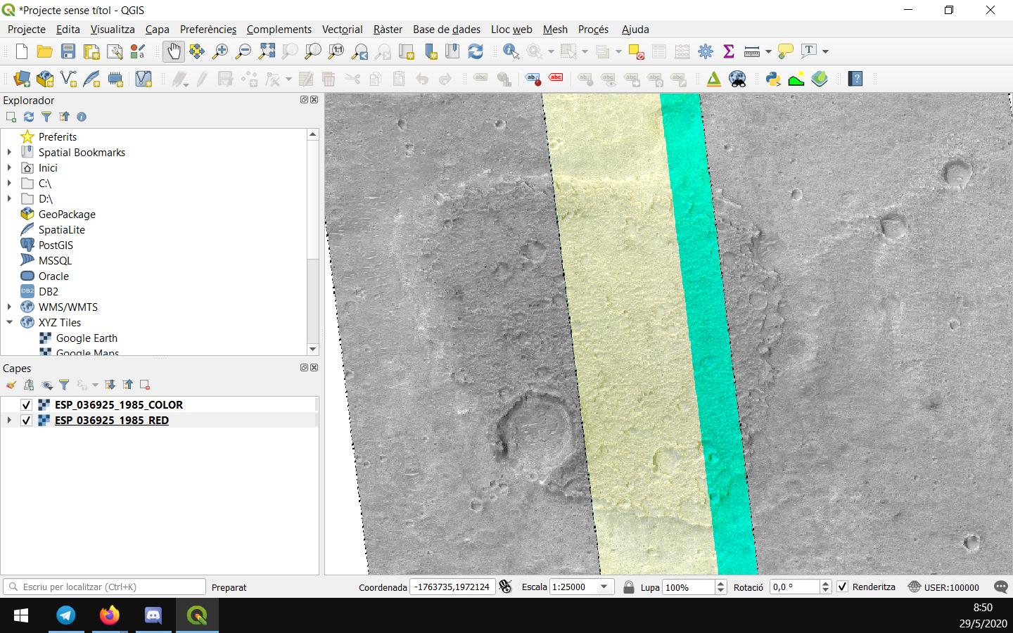
The images now should be correctly georeferenciatied:

If this doesn't worked for you, I would recommend to update to a newer version of QGIS and try it again.
You could use gdalinfo to get the actual projection used in the HiRISE RDR in WKT format. Between North and South 65 degrees latitude HiRISE does not use a projection with a fixed radius. You could also get the values from the LBL file, although not in WKT format.
