0

While building a geotemporal web app, I found that virtually all countries followed this simple four-level structure, akin to what we in the US of A call: city, county, state, nation.

However, most other nations use different terms for city, county, state, and nation.

Is there an "ISO" or similar standard for these names that would be recognized and accepted internationally? (hopefully globally)

1
  • I think it’s worth researching this one at the Open Data Stack Exchange.
    – PolyGeo
    Commented Jul 12, 2020 at 6:24

1 Answer 1

2

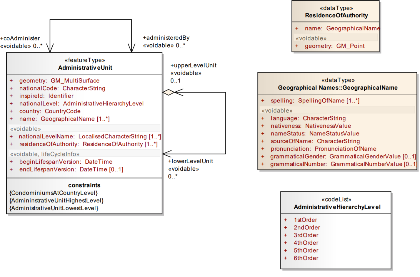
ISO currently doesn't standardize the hierarchical structure of administrative/statistical units. But, there is an EU directive called INSPIRE that specifies data models for 34 data themes in order to support harmonization of data on an EU level.

https://inspire.ec.europa.eu/Themes/114/2892

https://inspire.ec.europa.eu/Themes/125/2892

I know that it wouldn't apply outside of Europe, but you could use some of the concepts, perhaps. Generally, you can define level for each unit and this is a reference. A name of the level could be in English, Spanish or whatever language. The similar concept is applied for Statistical units.

Also, there is a global dataset of administrative regions that follows similar concept (https://gadm.org/)

INSPIRE administrative units UML class diagram

Your Answer

By clicking “Post Your Answer”, you agree to our terms of service and acknowledge you have read our privacy policy.

Not the answer you're looking for? Browse other questions tagged or ask your own question.