Background:
At 3.14.16, using the 64-bit network installer, under Windows 10, I am unable to load any NetCDF files.
For example, this instructional blog post:
https://opengislab.com/blog/2020/10/10/wind-vector-mapping-and-animation-in-qgis
has a link to its sample netCDF data
I have unsuccessfully attempted to load this .nc file using the following procedures:
- Drag & drop the file from Windows File Explorer into QGIS
- Layer > Add Layer > Add Mesh Layer...
- From the QGIS Browser Panel
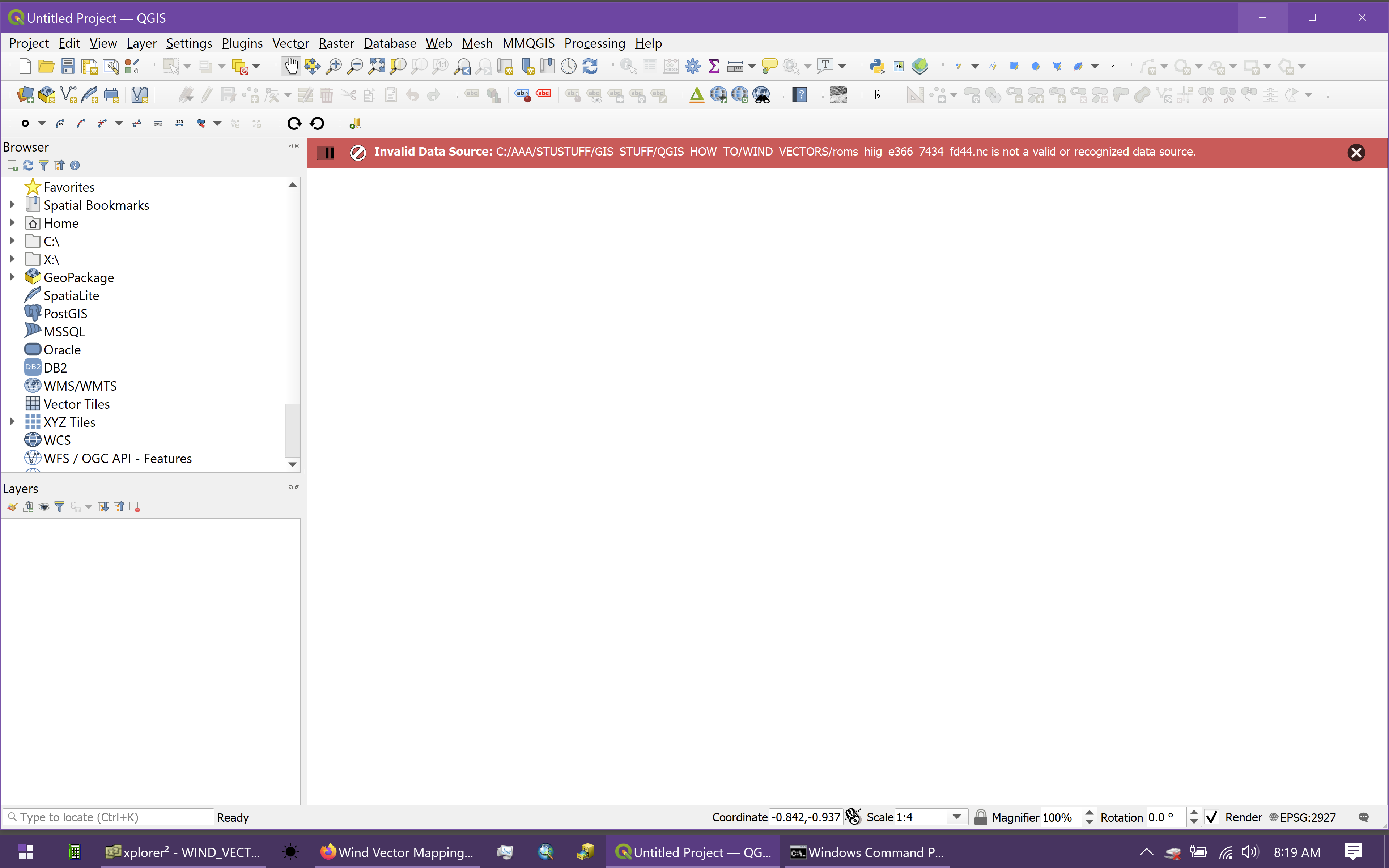
In every case, QGIS responded that the netCDF file was "...not a valid or recognized data source.", as shown in this screenshot:
Efforts to find a solution:
- I confirmed that the downloaded NetCDF file is valid using gdalinfo filename.nc. Although the output is too long to paste here, nothing in it indicated any sort of data error. Here are the first 5 lines:
Driver: netCDF/Network Common Data Format
Files: roms_hiig_e366_7434_fd44.nc
Size is 512, 512
Coordinate System is `'
Metadata:
- Confirmed that the gdal version supports netCDF, using gdalinfo --formats. The results show that the netCDF format is supported:
Supported Formats:
...
netCDF -raster,vector- (rw+s): Network Common Data Format
...
- Conducted an OSGeo4W Advanced Install and enabled all netCDF-related utilities and libraries; the results shown in this screenshot:
Problem:
Despite my attempts, QGIS will still not load any .nc files, responding every time that they are not a valid or recognized data source. What am I missing?
Update:
Using 2.18.28 I am able to successfully load the raster versions of the .nc file, but not the mesh versions. Still no success with either raster or mesh versions at 3.14.16.
Update #2:
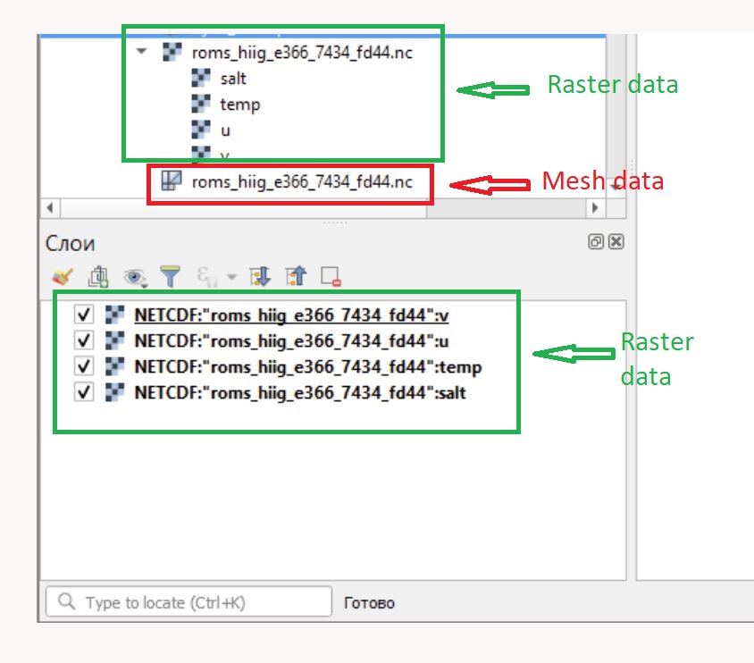
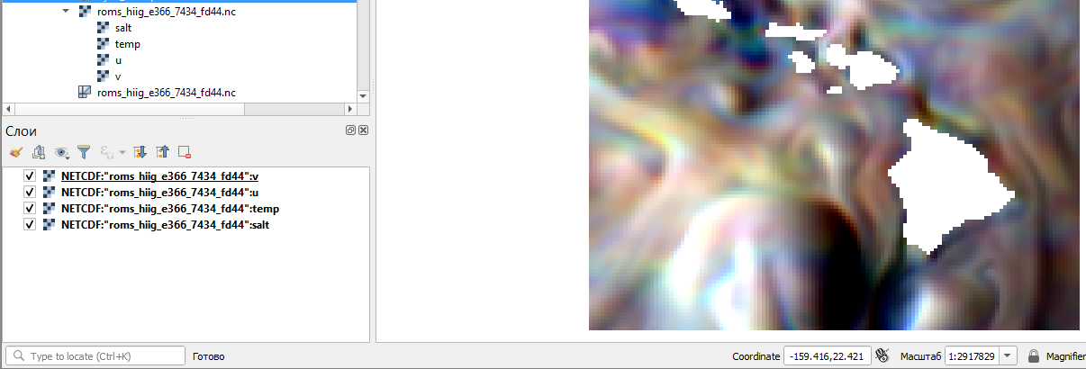
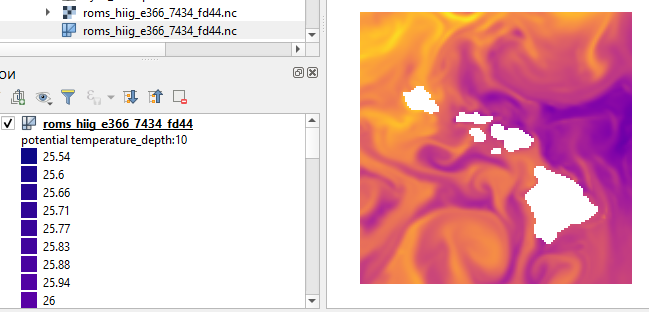
Although QGIS will not allow me to load the netCDF file at all, I am particularly interested in accessing the mesh netCDF data, not the raster version. The screenshot below (taken from Cyril Mikhalchenko's answer) of a netCDF file in QGIS shows the mesh data outlined in red. Note that the mesh data has a different icon than the raster data.

