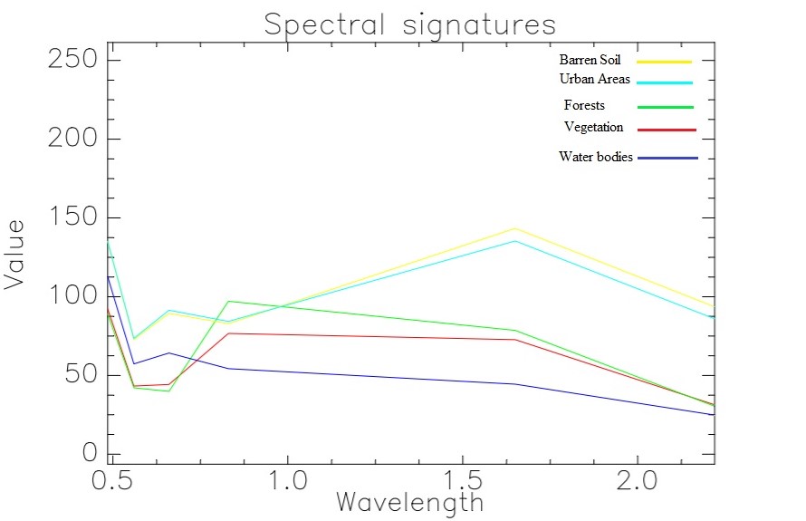
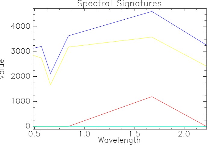
I did atmospheric correction of Landsat 5 image by Quick atmospheric correction method(QUAC), now I want to compare atmospheric corrected spectral signatures from ENVI QUAC with the input spectral
signatures of a Raw image. What differences are there, and why these differences occur?

Spectral signatures of a Raw image (Landcover features)
Spectral signatures of an Atmospherically corrected image

