I have not tested this inside an action, but here is a short recipe to create a QgsPalettedRasterRenderer and apply it to a raster layer. The only slightly tricky part is creating the color ramp. I think the easiest way is to retrieve a properties map from an existing color ramp. For example, if you set up your raster symbology the way you want it via the gui, you can retrieve the properties of the color ramp by running:
print(iface.activeLayer().renderer().sourceColorRamp().properties())
You can copy this properties map and use it to construct a color ramp object in your action code.
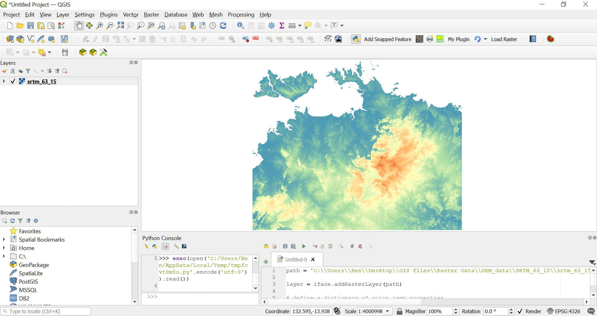
The example below constructs a spectral (blue-red) color ramp.
Try something like:
from qgis.utils import iface
from qgis.core import QgsGradientColorRamp, QgsPalettedRasterRenderer

baseurl = 'URL'
filename = "[% "LINK" %]"
path = f"/vsicurl/{baseurl}{filename}"
layer = iface.addRasterLayer(path)

# define a dictionary of color ramp properties
# this can be retrieved from an existing styled raster layer with:
# print(iface.activeLayer().renderer().sourceColorRamp().properties())
props = {'color1': '43,131,186,255',
        'color2': '215,25,28,255',
        'discrete': '0',
        'rampType': 'gradient',
        'stops': '0.25;171,221,164,255:0.5;255,255,191,255:0.75;253,174,97,255'
        }

# Create a gradient color ramp from the properties dictionary
color_ramp = QgsGradientColorRamp().create(props)

# Construct a class data list, passing in QgsRasterInterface object, band number & color ramp
classes = QgsPalettedRasterRenderer.classDataFromRaster(layer.dataProvider(), 1, color_ramp)
# Construct the renderer object, passing in QgsRasterInterface object, band number & class list
renderer = QgsPalettedRasterRenderer(layer.dataProvider(), 1, classes)
# Set renderer to layer
layer.setRenderer(renderer)
Shown below is the resulting symbology applied to a SRTM DEM raster:


