0

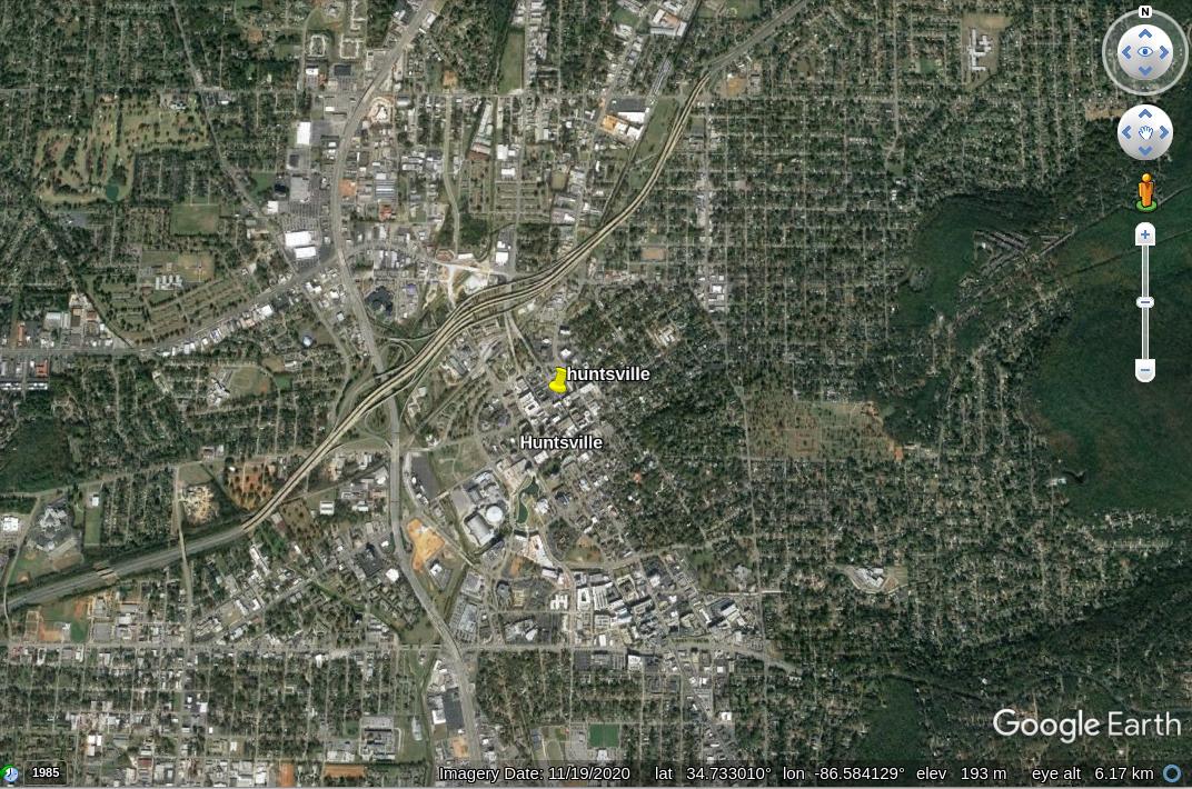
Say I'm looking at a place in Google Earth around 34.732530, -86.586623, around Huntsville AL.

huntsville

How can I easily find a google-earth-engine dataset that has the EO imagery for what I'm seeing? There are many datasets that cover this geographic location, but which one(s) have the optical images?

Looking for something like img = ee.Image('LANDSAT/LT05/C01/T1_SR/LT05_034033_20000913')

2 Answers 2

1

Satellite imagery come from different sensors. Some imagery is available in Earth Engine catalog and it is free. Some you may need to purchase yourself and upload to your private assets.

To your question - this is an example of one image from Sentinel-2 over your area:

var point = ee.Geometry.Point([-86.586623, 34.732530])

var s2 = s2all.filterBounds(point)
.filterMetadata("CLOUD_COVERAGE_ASSESSMENT", "less_than", 20)
.first() 

Map.addLayer(s2, s2Vis, "s2 image")

// to get a string
print(s2.get('system:id'))

You can use different filters to get an image for the data/area of interest:

  • .filterDate()
  • .filterMetadata()
  • .filterBounds()
  • etc (full list in documentation)

You can read more about filtering: https://developers.google.com/earth-engine/guides/ic_filtering

Link to the script with the example from your question: https://code.earthengine.google.com/856a203abf9951bed3d91c0fbc4fb299

1
  • s2all = ee.ImageCollection('COPERNICUS/S2') is what i needed for python. Many thanks!
    – khaverim
    Commented Nov 30, 2021 at 22:46
1

If you're asking to directly access the the high-resolution satellite and aerial imagery from Google Earth and use it for analysis in Earth Engine, then unfortunately the answer in almost all cases will be that it's not available for free in Earth Engine. As the other answer alluded to, most of the imagery in Google Earth & Maps is commercially provided data, sold by 3rd parties under licenses that allow it to be displayed through Google's mapping products, but not redistributed for other uses (for details see the Earth/Maps terms of service).

That said, you can find a lot of free, publicly available imagery in the Earth Engine data catalog, but most of that will be lower spatial resolution, though often much higher temporal resolution. For example, Landsat and Sentinel have between 10 and 30 meter resolution, and image nearly the entire earth about every 2 weeks. If that free data (and/or any private data you wish to upload to your account) can serve the analysis you want in Earth Engine, then you're good to go, but if you really need high-resolution imagery, you'll probably need to source it yourself. The only high-res imagery currently (2021) in the Earth Engine data catalog is the NAIP datasets (1m resolution, continental US only, every 3-5 years) and a few small patches of SkySat imagery from around 2015. More on those datasets here: https://developers.google.com/earth-engine/datasets/tags/highres

Your Answer

By clicking “Post Your Answer”, you agree to our terms of service and acknowledge you have read our privacy policy.

Not the answer you're looking for? Browse other questions tagged or ask your own question.