I received two sets of data that I would like to project in QGIS. The first set are png images of a map measuring 600 by 600 mm. These I already projected in QGIS using the georeferencer which was quite easy.
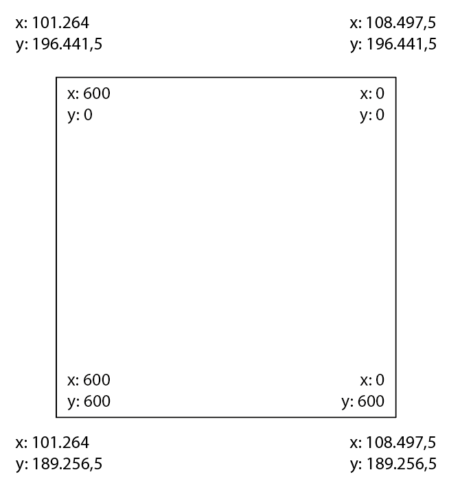
Now I also received an excel table with features of points with x and y coordinates. These coordinates however are a projection onto the image using a 600 by 600 XY-system (the size of the image). Now I would like to convert my CRS to be able to project my points in QGIS. Small detail, my point 0 is the right top corner of the image.
Very quickly as illustration of the problem. The inner coordinates are the generic coordinates based on the image size, the outer ones are the CRS coordinates after georeferencing the image.

I was wondering if a simple Excel calculation could work here?
