Is there a way to limit how much of a raster is shown in QGIS3 without clipping the raster to a new file? In my old workflow from Arcmap I would georeference scanned maps or rasters with tics in the margins (such as geophysical layers with local coordinate system), but when these are tiled together you don't want the "collar" or margins to show because they block adjacent rasters. We want to be able to view a contiguous raster display but have the option of turning on the collar view to see the edge information.
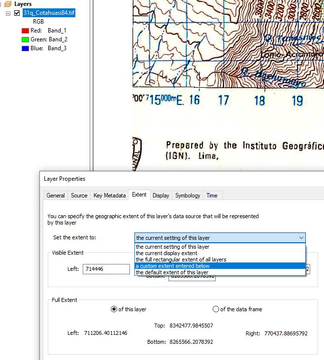
I haven't been able to re-create this workflow in QGIS because I must clip to limit the extent of the raster, and then I lose the information along the margins. While this functionality in Arcmap was only rectangular extent (not polygon-based) it's very useful because when you're allowed to keep the marginal info it retains local coordinates, or other critical information that really belongs in the raster. In QGIS I would expect it under Raster Properties > Source or Transparency or Rendering tab because in Arcmap it's under Raster Properties > Display > Extent > Set Extent to: Custom extent
Here's a screenshot of how it appears in Arcmap with the left (west) edge display clipped by UTM without affecting the source raster.
