1

How do I calculate the flow that goes through the rainfall drainage points under a railway?

I have two layers:

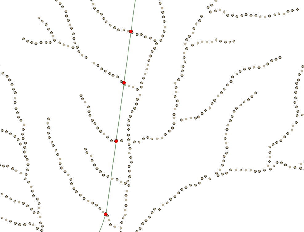
DT: Point layer with drainage information: DT_id and elevation.

ACA: Point layer with de flowrate information: ACA_id, flowrate and elevation.

I need the flowrate that is upstream of each drainage point. Therefore I want to get the nearest ACA point to each DT point. But I need to add the condition that the nearest neibour has to be more elevated than the related DT point, in order to be sure that we selected the point that is upstream and not the one that is downstream.

I have tried using the "distance matrix" but I can't find how to impose this condition.

enter image description here

3
  • Welcome to Geographic Information Systems! Welcome to GIS SE! We're a little different from other sites; this isn't a discussion forum but a Q&A site. Your questions should as much as possible describe not just what you want to do, but precisely what you have tried and where you are stuck trying that. Please check out our short tour for more about how the site works
    – Ian Turton
    Commented Sep 13, 2022 at 16:12
  • select higher points and then look for the nearest neighbour?
    – Ian Turton
    Commented Sep 13, 2022 at 16:12
  • Thank you for the welcome! I have tried to improve my question to be more specific.
    – Ferran
    Commented Sep 13, 2022 at 16:23

1 Answer 1

3

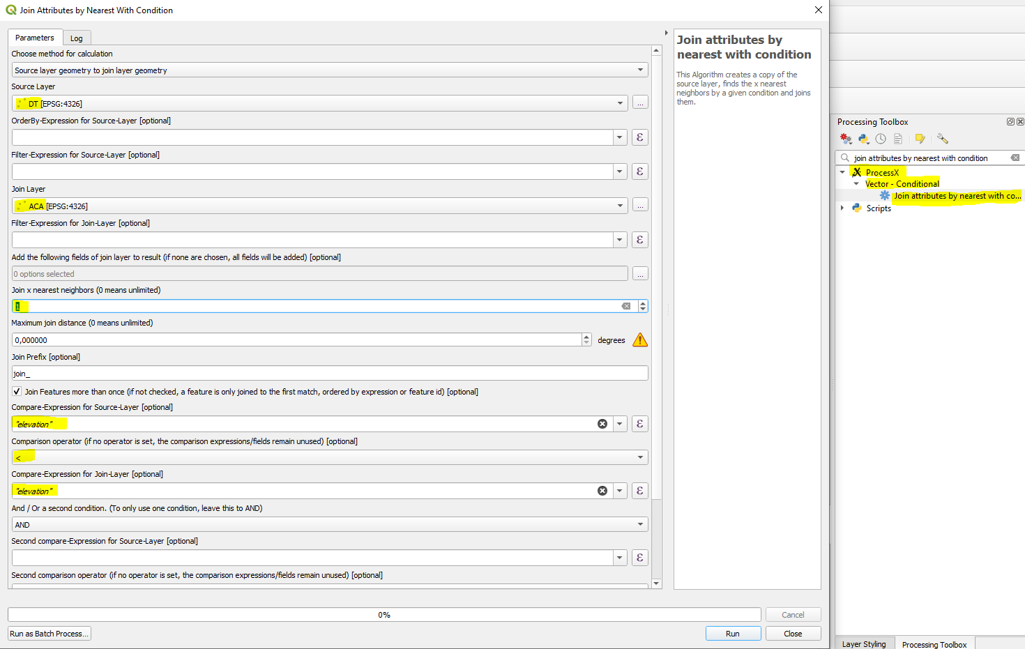
You can use ProcessX Plug-In and run the algorithm Join attributes by nearest with condition from processing toolbox. Set it up the following:

enter image description here

Disclaimer: I am the author of this Plug-In.

0

Your Answer

By clicking “Post Your Answer”, you agree to our terms of service and acknowledge you have read our privacy policy.

Not the answer you're looking for? Browse other questions tagged or ask your own question.