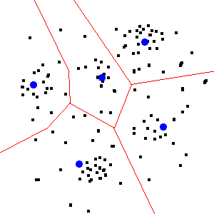
I am trying to compare locations of where several thousand facilities have been actually built to where they would be optimally located to minimize travel times of the population (represented by census block or tract centroids). I'm having trouble finding much of anything on how to optimally locate points.
I've got some idea of how to go about choosing these locations, but the sheer number of points to be placed in space means that any non-cleverly optimized algorithm is going to take a long time, possibly years. Thus my question: Are there standard algorithms for choosing where to locate a fixed number of points?
I will ultimately take whatever algorithm I find as a starting point and adapt it to incorporate more information than just the population counts. Thus the preferred answer would include a detailed description of the algorithm, code, or be written in an open-source language, so that I can replicate and extend it. However, if ArcGIS has a convenient function for this optimization, I'd be happy to start with that.

