0

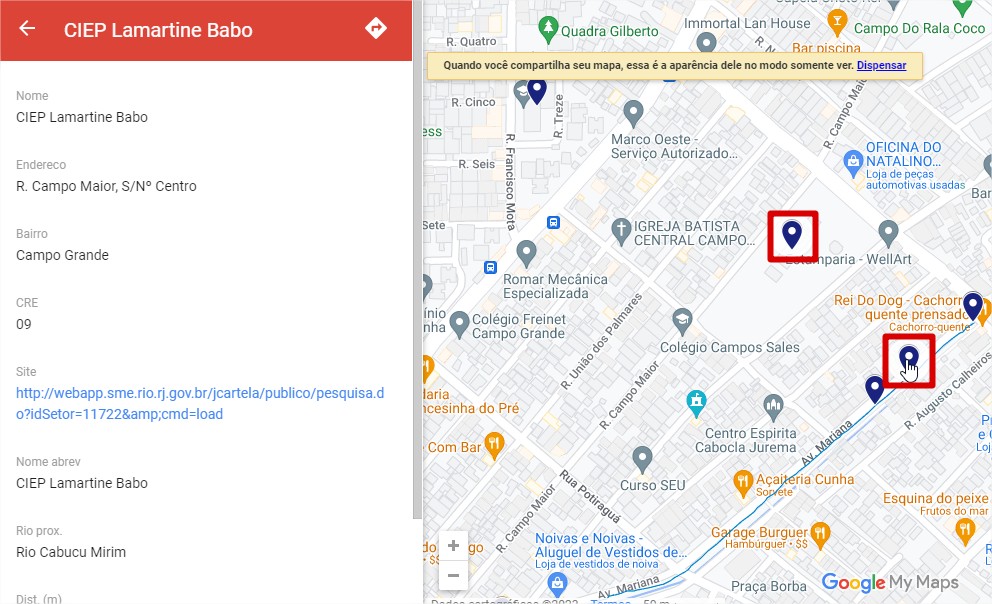
I have created a Google My Maps project with only two layers: one of them is made by points representing schools and the other one is made by lines representing rivers. Some schools, however are represented by 2 points as a part of some bug. Whenever I hover my mouse over of them, both are surrounded by a light halo, indicating the are connected and have the same atributes.

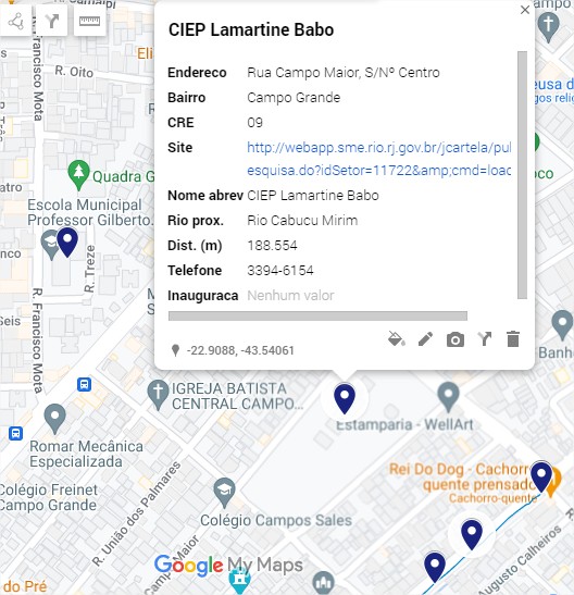
The two points, one under the mouse and one further northwest are surrounded by the halo mentioned beforehand

It gets weirder. There's a box with information related to the point feature and it doesn't matter which of the two points I click, the box opens - always over the same point.

Box opened with related info in portuguese

During Edit mode, I've found out that if I edit the feature in any way, the replicated point dissapears, leaving behind just the "true" point.

Below you can find a step-by-step example of an edit that makes the point disappear:

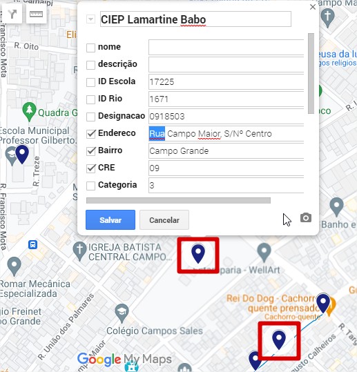
Editing the box of information

  1. I open the atributes of the feature and I edit the word "Rua".

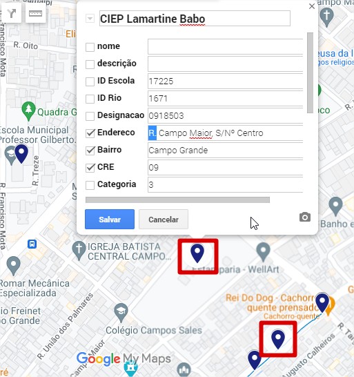
Edited box

  1. "Rua" becomes "R."

Point disappears after I save

  1. Upon saving, one of the points disappears.

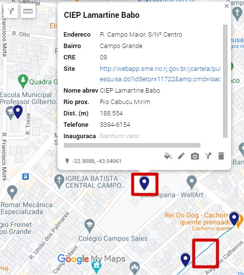
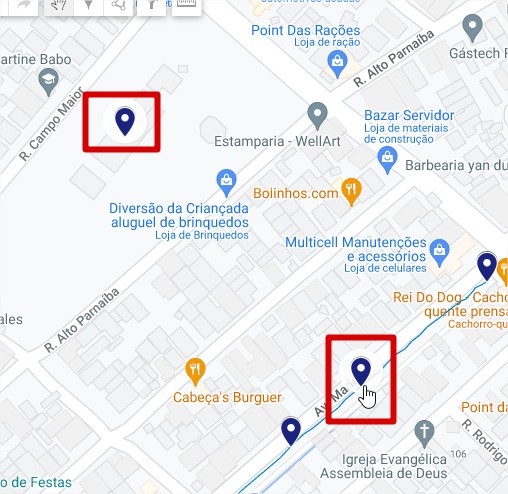
The problem is the point only disappears during edit mode. If I change to "view mode" or if I embed it on a website, both points are still there. (You can recognize View Mode when the information related to a point is displayed on the left side, rather than on a bubble)

During View Mode, the point returns to its location

You can access the map here (Google MyMaps) or here (embedded in website). Both links display doubled features, but it doesn't happen on Dev/Edit mode.

I want the maps to display exactly as I see in edit mode, without the doubled points. I've tried re-importing the point .KML file to Google MyMaps, but they always appear as doubled features. I can't re-download the layer, as I'm the one who generated it.

4
  • I downloaded your KML file and it is over the max limit for MyMaps support.google.com/mymaps/answer/…
    – Mapperz
    Commented May 18, 2023 at 21:26
  • You mean the row limit? There's no feature with more than 2000 rows
    – Eric Lino
    Commented May 19, 2023 at 14:01
  • Unzipped KML and KMZ files can be up to 5 MB. your kml is 10mb.
    – Mapperz
    Commented May 19, 2023 at 15:06
  • Maybe it was some difference in compression from google maps, because if it was larger than 5mb, Google My Maps wouldn't even let me upload it.
    – Eric Lino
    Commented May 31, 2023 at 14:43

1 Answer 1

2

After thorough examination, I've realized that the doubled points issue happened before importing th edata on Gogle My Maps. More precisely, after executing the "distance matrix" algorithm in QGIS. It creates a point where the distance between two features is smaller, thus, transforming my data into a multipart shapefile. The issue was corrected with the following processing:

1: Multipart to Singlepart on the latest shapefile to make sure each point has it's own row on the attribute table;

2: Select By Location tool comparing the latest shapefile and the original point shapefile (before distance matrix) to create a selection where both layers intercept;

3: Save selected as... on latest shapefile

This will produce a shpaefile with the same geographical properties as the original file and discard the issue generated by distance matrix.

Your Answer

By clicking “Post Your Answer”, you agree to our terms of service and acknowledge you have read our privacy policy.

Not the answer you're looking for? Browse other questions tagged or ask your own question.